Artículo agregado a tu carrito
Carretera austral sur.
- Duración 6 días y 5 noches
- Nivel de actividad Light - Moderada
- Tipo de actividad Familiar- Naturaleza
- Tamaño del Grupo 28 personas
No se pudo cargar la disponibilidad de retiro

¿Tienes dudas?
Si necesitas más información, contáctanos y recibe la mejor atención del mundo.
Certíficaciones

- Descripción
Fechas Disponibles
¿qué incluye, ¿cómo reservar, preguntas frecuentes.
- Reservar ahora
¡Bienvenidos a un espectacular viaje de 6 días y 5 noches a través de la sorprendente belleza de Coyhaique, Puerto Río Tranquilo y Cochrane!
Esta aventura los llevará a explorar paisajes inigualables, desde majestuosas catedrales de mármol hasta la confluencia de ríos y el encantador pueblo de Caleta Tortel.
Prepárense para una experiencia única en la región de Aysén, donde cada día les reserva nuevas maravillas por descubrir. Destacados del Itinerario: ✨Navegación Catedrales de Mármol ✨ Visita a Caleta Tortel ✨ Visita a la Confluencia de los Ríos Baker y Neff ✨ City Tour por Coyhaique

- 06 al 11 de Septiembre 2024 ➞ $775.000 Reservar ahora
- 13 al 18 de Septiembre 2024 ➞ $795.000 Reservar ahora
- 26 de Septiembre al 01 de Octubre 2024 ➞ $765.000 Reservar ahora
- 01 al 06 de Octubre 2024 ➞ $795.000 Reservar ahora
- 17 al 22 de Octubre 2024 ➞ $795.000 Reservar ahora
- 30 de Octubre al 04 de Noviembre 2024 ➞ $845.000 Reservar ahora
- 02 al 07 de Noviembre 2024 ➞ $825.000 Reservar ahora
- 05 al 10 de Noviembre 2024 ➞ $825.000 Reservar ahora
- 13 al 18 de Noviembre 2024 ➞ $825.000 Reservar ahora
- 22 al 27 de Noviembre 2024 ➞ $825.000 Reservar ahora
- 06 al 11 de Diciembre 2024 ➞ $835.000 Reservar ahora
- 09 al 14 de Diciembre 2024 ➞ $855.000 Reservar ahora
- 14 al 19 de Diciembre 2024 ➞ $855.000 Reservar ahora
- 17 al 22 de Diciembre 2024 ➞ $855.000 Reservar ahora
¿Ninguna fecha te funciona? Danos tu correo y te avisamos cuando se abran nuevas fechas

- Pasaje aéreo Santiago a Balmaceda ida y vuelta.
- Bus privado para el grupo durante todo el recorrido.
- 01 Equipaje de Cabina + 01 artículo personal.
- Régimen de alimentación de media pensión. (05 desayunos y 05 almuerzo/cena según programa).
- Alojamiento en base a habitaciones dobles, matrimoniales o triples, en hotel, hostales y/o cabañas donde existe la posibilidad de compartir baño con otros pasajeros del tour.
- Traslado en bus exclusivo para el grupo durante todo el tour.
- City tour en Coyhaique, entrada a la Carretera Austral.
- Navegación al Santuario de la Naturaleza Capillas de Mármol, uno de los mayores hitos del viaje.
- Conoceremos Puerto Tranquilo, pequeña localidad ubicada en la ribera del Lago General Carrera.
- Visita Confluencia río Baker y río Neff, una postal inolvidable.
- Visita al Parque Patagonia, ex Parque de Douglas Tompkins.
- Visitaremos Cochrane, puerta de acceso a los Campos de Hielo.
- City tour en Coyhaique, entrada a la Carretera Austral
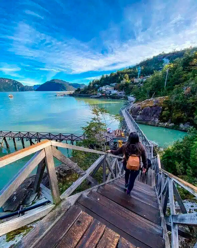
- Conoceremos Caleta Tortel, el único pueblo de pasarelas.
- Impuestos aéreos.
- Coordinador de la Agencia durante todo el viaje.

PARA RESERVAR: ¡Comunícate con nosotros vía correo, Instagram, Facebook, WhatsApp o teléfono y te indicaremos los pasos a seguir! También puedes reservar en nuestra página web www.geoterraviajes.cl y seguir los pasos señalados.
RESERVA: Aprovecha y reserva sólo con $50.000 por persona. Este monto se descuenta del valor total del viaje y no es reembolsable en ningún caso.
SALDO: Puedes ir pagando mensualmente vía transferencia/depósito en cuotas sin intereses.
Para Viajes Nacionales y tour Salar de Uyuni , el tour debe estar 100% pagado 40 días antes de la fecha de salida del viaje.
De no ser así, los pasajeros serán excluidos del viaje sin devolución de lo abonado.
- Para inscripciones a menos de 40 días (nacional) del viaje no es posible reservar, sólo se confirma la reserva de los cupos con el pago de la totalidad del tour.
- CUENTA BANCARIA PARA TRANSFERENCIAS O DEPÓSITOS EN PESOS CHILENOS:
- Nombre :Agencia de viajes Geoterra SPA.
- Rut: 77.232.193-7
- Número de cuenta: 2402434004
- Tipo de cuenta: Cuenta corriente
- Banco: Banco de Chile
- Correo: [email protected]
* Recuerda agregar en los comentarios tu nombre, tour y fecha de viaje.
* Es responsabilidad del pasajero notificar a Geoterra Viajes de cada abono o pago realizado.
Al momento de reservar, estarás aceptando nuestros Términos y Condiciones y las Políticas de Devolución y Anulación .

Día 1: Santiago – Balmaceda- Puerto Tranquilo
- Partimos nuestro viaje hacia la Patagonia chilena desde el aeropuerto de Santiago, todos juntos.
- Nuestra primera parada es Coyhaique, ciudad capital de la región de Aysén.
- Vamos a recorrer la ciudad y pasear por los lugares más icónicos, como lo es el mirador Marchant, su especial plaza de armas y sus artesanías.
- Se incluye almuerzo y alojamiento en esta ciudad.
Día 2: Catedrales de Mármol
- Desayuno incluido.
- En la mañana bien temprano, partiremos hacia el poblado de Puerto Tranquilo, precioso lugar que queda a las orillas del lago de color turquesa, General Carrera.
- Acá navegaremos por las catedrales de mármol que deslumbran con su belleza única e increíble. Descansamos y luego disfrutamos de una cena ( incluida) para terminar el día.
- Alojamiento en Puerto Tranquilo.
Día 3: Puerto Tranquilo-confluencia del río baker y neff- Cochrane
- Emprendemos viaje a Cochrane, pero antes haremos una parada para deslumbrarnos con la confluencia del río Baker y el río Neff, que cuenta con un desnivel en los cursos de agua de más de 10 metros, provocando un salto de agua de magnitud y con un marcado contraste entre las turquesas aguas de ambos ríos que es deslumbrante, para llegar a este hermoso sitio hay que caminar aprox 20 minutos y la caminata es para todas las edades.
- Luego seguimos camino a Cochrane.
- Cena incluida y Alojamiento.
Día 4: Caleta Tortel
- Muy tempranito en la mañana, nos iremos rumbo hacia la bella localidad de Caleta Tortel, el famoso Pueblo de las Pasarelas, ubicado en una zona de fiordos y canales, rodeado de bosques y glaciares, un pueblito de lo más lindo y pintoresco con una arquitectura única que definitivamente es uno de los hitos más relevantes de nuestro recorrido.
- Luego regresamos a Cochrane.
- Cena incluida.
Día 5: Parque Patagonia- Cochrane
- Después de un delicioso desayuno, vamos a conocer el Parque Patagonia, ¡que es un lugar increíble para visitar!
- Este parque nacional es conocido por su impresionante belleza natural y su diversidad biológica, podremos explorar una variedad de paisajes, como bosques, ríos y montañas, y disfrutar de vistas panorámicas espectaculares.
- Después volveremos a Cochrane para una merecida cena y nos alojaremos en Cochrane.
Día 6:Cochrane- Balmaceda- Santiago.
- Ya listos con las maletitas hechas y el corazón contento, tomamos desayuno y partimos rumbo a Balmaceda para tomar el vuelo que nos llevará de regreso a Santiago..

- Al seleccionar una opción, se actualiza toda la página.
- Se abre en una nueva ventana.
Travel the Carretera Austral, the essential guide
In this complete guide to travel the Carretera Austral you will find information to travel the scenic Chile’s Southern Highway, one of the most beautiful in the world.
The Carretera Austral starts in the city of Puerto Montt , crosses scenic landscapes between lakes and mountains, culminating after 1230 km in the town of Villa O’Higgins . Let’s describe it in this complete guide.
Table of Contents
Getting to some of the starting points of the Carretera Austral
There are several alternatives to travel the Carretera Austral . Taking into account that normally the starting point is from the city of Puerto Montt in the north or from the region of Aysen in the extreme south.
– Arriving at one of the starting points by plane
- Getting to Puerto Montt : It is possible to get to Puerto Montt, the starting point for visiting the Carretera Austral in the north, on a flight from Santiago de Chile, Punta Arenas or Balmaceda. There are regular flights every day.
✈️ Check here for cheap flights to Puerto Montt .
- Getting to Balmaceda : The airport is located on the southern part of the Carretera Austral, very close to the border with Argentina and 57 kilometers from the town of Coyhaique. There are direct flights from Puerto Montt or Santiago de Chile.
– Can it be done by bus?
Visiting the Carretera Austral by bus is not impossible . You just have to take into account the infrequency of public transport . In addition, you often have to make several combinations to get from one place to another. If you arrive in Chile via Santiago, the best way is to get to Puerto Montt by bus or plane and from there rent a car.
– Visiting the Carretera Austral in your own or rented car
It is clear that the best option to travel the entire Carretera Austral and stop to enjoy the landscapes is either in your own car or a rental car.
It must be taken into account that the route is cut in three sections due to the accidents of the terrain.So you have to do part of this route aboard a ferry. The three navigable stretches are:
- Caleta La Arena to Caleta Puelche : 45 minutes of navigation.
- Hornopirén to Leptepu : 4 hours of navigation.
- Fiordo Largo to Caleta Gonzalo : 45 minutes of navigation.
🚗 See here the prices of rental cars in Puerto Montt .

– Doing the Carretera Austral by ferry
If you are going to travel the Carretera Austral, there are options to a rrive by ferry to different points . And by the way, you can see the fjords and the entire coast of southern Chile:
- Route from Puerto Montt to Chaitén or to Puerto Chacabuco : in the first case, it is about 10 hours of navigation and in the second, it is a day of navigation.
🚢 Check the route from Puerto Montt to Chaitén with Naviera Austral (in Spanish). 🚢 Check the route from Puerto Montt to Puerto Chacabuco with Navimag .
- Route from Quellón in Chiloé : if you are on the island of Chiloé there are several ferries that connect Quellón with different ports of the Carretera Austral such as Chaitén, Puerto Cisnes or Puerto Chacabuco.
Check the route from Chiloé with Naviera Austral (in Spanish).
- Route from Puerto Natales : it is possible to travel by ferry through the Ice Fields region from Puerto Natales , passing through Puerto Eden and arriving at Puerto Yungay.
🚢 Check the route from Puerto Natales with Transbordadora Austral .
So, what is the best option?
As we have already commented before, the best way to visit the Carretera Austral is to do it by own or rental car , unless you want to visit only a section or navigate. Public transportation between cities is limited and there is no service every day.
Keep in mind that if you visit the Carretera Austral by car, the further south you go the greater the distance between towns, although fortunately gas stations are no longer a problem as you can fill up in most of the towns along the Carretera Austral (Hornopiren, Chaitén, Futaleufú, Palena, La Junta, Puyuhuapi, Puerto Cisnes, Puerto Aysén, Puerto Chacabuco, Villa Maniguales, Coyhaique, Puerto Río Tranquilo, Villa Cerro Castillo and Chile Chico). La Junta, Puyuhuapi, Puerto Cisnes, Puerto Aysén, Puerto Chacabuco, Villa Maniguales, Coyhaique, Puerto Río Tranquilo, Villa Cerro Castillo and Chile Chico, Cochrane, Tortel). However, many sections of the Carretera Austral are still gravel roads , although they are gradually being paved.
Along the Carretera Austral, there are several border crossings with Argentina . These are: Futaleufú in Chile with Esquel and Trevelin, Chile Chico with Los Antiguos and Balmaceda with Estancia Valle Huermules.

Are there ATMs to withdraw money?
Yes, fortunately many of the cities and towns on the Carretera Austral have ATMs for withdrawing money. Puerto Montt, being the largest city, has the most ATMs. But places like Puerto Río Tranquilo, Coyahique, Puerto Cisnes, Chile Chico, Chaitén and Puerto Aysén also have ATMs for cash withdrawals.
You can pay by card in many gas stations and shops , but keep in mind that in remote places the connection is often unstable and therefore sometimes you can’t pay by card even if the shop has a device to do so.
Do you need to carry enough cash to do the Carretera Austral? Our advice is not to skimp on this . If you stop at a petrol station to fill up and the system fails, you will have to pay in cash. The same goes for shopping or eating in a restaurant. The advantage is that you can pay for items such as hotels and excursions in advance by credit card.
Best time to travel the Carretera Austral
The best time to visit the Southern Highway is during the summer , late spring and early fall (from November to April) when the weather is pleasant during the afternoon. In addition, the length of the day, in terms of sunlight, is long. As the route is so vast, the further south you go the weather will tend to be colder, so it is recommended to bring warm clothes , even if the visit is in summer.
There are certain places where the visit should be done outside the summer season. This is the case of the Marble Chapel (Capillas de Marmol). During this time of year the lake water rises considerably due to thaws and it is not possible to go into the caves.
In the southern part of the Carretera Austral, the frequency of rains is constant , so it is recommended to bring a raincoat. It can even snow in summer.
From May to September the weather is very col d and, added to the fact that most of the activities are outdoors, it is difficult to visit the sites.

Accomodation in Southern Highway
🏨 Check here where to stau in Carretera Austral and get your ideal accommodation.
Must-see sights and attractions in Carretera Austral
- Top 5 things to do in Carretera Austral
- Other attractions to visit in Carretera Austral
Activities to do in Carretera Austral
- Take a break at the hot springs
- Mountain biking
- Navigation through channels

Comparte esta entrada:
The Carretera Austral: How to Plan Patagonia’s Most Magnificent Road Trip
By Author Steph Dyson
Posted on Last updated: 18th January 2024
Chile doesn’t always make it to the top of traveler’s itineraries. Travel costs and a more European culture compared with other South American countries have diminished its appeal.
But those who give it a chance learn something that the thriftier travelers don’t: Chile is stunning . And the best place? Patagonia’s Carretera Austral.
The Carretera Austral road trip: a true Patagonian adventure
When I first arrived in Patagonia back in March 2016, it was in the back of a purpose-built overlanding truck.
Little did I know that this was the start of a love affair that would see me spending the next three years visiting the length and breadth of Chile . Its diverse natural beauty and welcoming culture saw me falling head over my walking boots in love.

Before I got to Patagonia, I had been struck by the adventurous possibilities of the vast deserts and salt flats of the Atacama Desert in the north and the vineyards and snow-topped mountains crisscrossed with ski runs that surround Santiago .
But then I stumbled upon the Carretera Austral.
Click to navigate this article:
Why I love Chilean Patagonia’s Carretera Austral
I’ve since returned practically every year to explore even further and deeper into what is northern Chilean Patagonia’s only highway.
I’ve taken almost all of the ferries that you can to get here. I’ve travelled by bus and car; I’ve hitchhiked and even gone on foot along stretches of this famed highway.
I’ve trekked into the rugged depths of its various national parks, climbed to lofty viewpoints above sweeping landscapes of lush temperate rainforests, sat in the spray of powerful waterfalls and stood in awe beneath egg-blue glaciers that seem to tumble from cliffsides as you watch.
For me, the Carretera Austral is the pinnacle of why Patagonia holds its travellers in an indescribable awe. It beats the allure of Torres del Paine National Park in the south and is packed with enough glaciers and pristine lakes to give the Perito Moreno glacier and Parque Nacional Los Glaciares in Argentina a run for their money. It’s one of my favorite places – and contains some of the best destinations to visit in Patagonia (and Chile in general!).

What you can expect to discover here are endless opportunities for camping and trekking, appreciating nature at its most remote and untouched and being fortunate enough to experience Patagonia’s – and perhaps South America’s – most incredible road trip.
What, and where is the Carretera Austral?
The Carretera Austral (which means “Southern Highway”) refers to the 1,240-kilometer (770-mile) road that runs from Puerto Montt to Villa O’Higgins all the way through northern Chilean Patagonia.
Also known as Ruta 7 (“Route 7”) or the “Ruta Austral” (the “Southern Route”), this road connects its northernmost point, Puerto Montt (in the Chilean Lakes District), and its southernmost point, Villa O’Higgins (in the Aysén region).
It spans a territory that is divided from Argentina in the east by the Andes Mountains and bookended in the west with the narrow channels and fjords of the Pacific Ocean.
What makes it so captivating a destination to visit is the fact that the Carretera Austral remains the only road connecting Puerto Montt and the deep, remote regions of Northern Patagonia.
This region is among the least inhabited in Chile , with – on average – fewer than one person per square kilometer living here.
What you’ll quickly realise is that this lack of habitation is evidenced in other ways: namely through the state of the road.
Don’t be fooled: the name The Southern Highway disguises the fact that the Carretera Austral remains a work in progress, with vast tracts of the road still unpaved.
And why is it so famous?
It’s partly because of its poor state that the Carretera Austral has reached such elevated status in travellers’ imaginations. Unpaved, pot holed and impassable due to the elements: all of these are qualities have helped secure the Carretera Austral as one of South America’s most remote – and therefore most beguiling – road trips.
Another feature of the road’s infamy is the fact that it was one of the main infrastructure legacies of the Pinochet dictatorship (which also killed and “disappeared” over 40,000 people).

Prior to the 1980s, this part of Patagonia was practically unconnected from outside civilisation, with no roads linking the majority of the settlements that were beginning to grow.
Construction of the road took twenty years and locals still refer to it as “Pinochet’s Highway”. You can even find a monument to the dictator in La Junta.
The Carretera Austral is also part of the brand new Ruta de los Parques , an initiative stretching 2,735 kilometres from Puerto Montt to the very tip of Patagonia at Cape Horn that aims to join up 17 Chilean national parks.
Although international press has reported it as such , this is not a contiguous hiking route. Instead, the Route of the Parks is a marketing exercise to showcase the wealth of nature that Chilean Patagonia contains.
Planning Your Trip to Patagonia?
Save time, stress & money with a customized travel itinerary planned for you by a Patagonia expert
If you want to explore it, the Carretera Austral is an excellent place to start: 10 of the 17 national parks are located here and the majority are accessible by car or bus with day and multi-day hikes awaiting.
Know-before-you-go facts about the Carretera Austral
- How long is the Carretera Austral? It’s 1,240km (770-miles).
- How long does it take to drive from Puerto Montt to Villa O’Higgins? Between 29-35 hours, depending on road works.
- What are the main towns along the Carretera Austral? Chaitén, Puerto Aysén, Coyhaique, Chile Chico, Cochrane.
- Where are supermarkets located? Coyhaique (UNIMARC).
- Where are ATMs located along the Carretera Austral? Chaitén, Futaleufú, Coyhaique, Chile Chico, Cochrane, Villa Cerro Castillo.
- Where are gas stations located? Hornopirén, Chaitén, Futaleufú, La Junta, Puyuhuapi (diesel only), Puerto Cisnes, Mañihuales, Puerto Aysén, Puerto Chacabuco, Coyhaique, Puerto Río Tranquilo, Chile Chico, Cochrane, Villa O’Higgins, Villa Cerro Castillo.
- Where can I rent camping equipment? Coyhaique ( Rent a Tent Chile ).
Listen to me talking about the Carretera Austral
In September 2020, I joined Chris from The Amateur Traveler discussing my favourite itineraries and destinations along the Carretera Austral. You can listen to the episode here:
How to explore the Carretera Austral: a Patagonian road trip, bus-to-bus or hitchhiking
The Carretera Austral is the perfect place for a journey and there are plenty of different ways to approach this road.
For those with larger budgets, a rental car is the ideal means; for those on smaller budgets, buses can help you hop between the different towns. Hitchhiking – if you’ve got plenty of time and patience – is another rewarding choice.
You can get plenty more information in my guide to car hire for the Carretera Austral and Patagonia .
Where to hire a rental car in Patagonia
As a prime spot for a Patagonia road trip, the Carretera Austral is approached by many via car, as you can traverse the whole route at a leisurely pace and enjoy its various ferry crossings.
In the north: Aeropuerto Internaciónal El Tepual , the airport just outside of Puerto Montt , has some of the cheapest car rentals I’ve found in Chile, with rental rates starting from $30,500 CLP ($37 USD) per day. You can book through Rental Cars , a comparison and booking site I’ve used on numerous occasions, however, some of the companies do not allow you to drive on the Carretera Austral or take ferries with your vehicle. Therefore, either check the terms and conditions of the booking thoroughly or book through Econorent , who definitely do allow you to take a vehicle on the Carretera Austral.
Along the Carretera Austral: Another option is from Aerodromo Balmaceda. Prices are much higher than in Puerto Montt and you can expect to pay at least $560,000 CLP ($768 USD) for a week’s rental. You can check up-to-date prices with Rental Cars , the company I use when hiring cars in Chile.
However, RecaSur often has availability and doesn’t necessarily show in Rental Cars’ database, so check there, too.

In the south: The cheapest place to pick up a rental vehicle is in Punta Arenas, although there are also rental companies in Puerto Natales.
From my experience, prices are cheaper if you rent from the Chilean side rather than the Argentine side of Patagonia, but it’s worth shopping around.
Know-before-you-go: Hiring a car for the Carretera Austral
Where to hire a campervan for the carretera austral.
Hiring a campervan for the Carretera Austral is also very popular – particularly as it allows you to stop as and when you wish along your journey.
In the north: The best place to pick up your new wheels is from Puerto Varas (a 30-minute drive northeast of Puerto Montt) with Ruka Motors or Wicked Campers .
Expect to pay $483,000 CLP ($662 USD) for a one-week rental. Prices will be significantly higher if you rent from one destination and return to another.
Along the Carretera Austral: You can also pick one up in Coyhaique from Recasur . Prices will likely be higher here because of lack of competition, however, if you’re struggling to find a hire car on Rental Cars, RecaSur often have vehicles to rent.
In the south: Punta Arenas has a number of rental agencies; Andes Campers , Wicked Campers and Holiday Rent have depos here. Expect to pay $480,000 CLP ($658 USD) for a one-week rental.
Top tips for a road trip along the Carretera Austral
The Carretera Austral is widely considered Patagonia’s finest road trip. Part of the appeal is how beautiful the landscapes are and the fact that, with your own transport, you can stop practically anywhere you wish for a photograph, for a picnic, or even to camp overnight.
Struggling to plan your Carretera Austral road trip?
Get the expert (me!) to plan out the perfect route down this famed road. I’ll give you all the logistical information, accommodation and tour recommendations, and local knowledge you need to have an unforgettable trip.
Learn more about my trip planning here .
Want someone to do all the legwork? EcoChile Travel, one of my recommended partners in the area, offers an incredible 19-day self-drive tour of the Carretera Austral . Combining a range of guided and self-guided excursions, it’s perfect if you want someone else to deal with the logistics of your tip!
Get a 5% discount on this trip by mentioning Worldly Adventurer when you book .

As a route in constant construction and facing less-than-predictable weather, it’s essential to be well-prepared before you set off:
- Allow yourself a flexible itinerary . In Patagonia, things don’t always go quite to plan.
- Two weeks is enough time to drive, and enjoy, most of the Carretera Austral; three weeks is even better . However, because of the prohibitively high costs of one-way rentals, it makes financial sense to hire and drop off your vehicle in the same place. As a result, you could start in Puerto Montt and head south to Puerto Río Tranquilo, before turning around and driving back to Puerto Montt. Alternatively, fly into Balmaceda (where you can rent a car using Rental Cars ) and head north to Puyuhuapi, south back down to Caleta Tortel, with plenty of time to explore the attractions en route, before returning to Balmaceda to drop the car. If you’re keen on seeing those within striking distance of Coyhaique, a week is enough to drive up north to and from Puyuhuapi and south to and from Cochrane, both of which are a day’s drive.
- A 4WD vehicle is not essential but a high-clearance vehicle and patience are indispensable.
- Around 90% of the road from Puerto Montt to Puyuhuapi is now paved. South of Puyuhuapi, you’ll encounter gravel roads and plenty of construction projects This portion is less pleasant to drive, but the scenery and the feeling of remoteness are incomparable. Road construction on the stretches directly south of Puyuhuapi, Coyhaique, and Villa Cerro Castillo, can add up to an hour of driving time and 1pm through 5pm is peak time for road closures. You can check for this information in the tourist information offices in Puerto Montt (Oficina de Turismo, San Martín 80) or Coyhaique (SERNATUR, Bulnes 35).
- You can find updates on the state of the roads here (English).
- This site (English) gives you information about the different border crossings along the Carretera Austral.
- Avoid driving faster than 60 kilometers per hour. Possible hazards include tire punctures, chips to the windscreen from gravel, and unexpected wildlife on the road. Pack food, water, and a sleeping bag in case of breakdowns. When picking up your vehicle, double-check it has its spare tire – you may well want it!
- Pack food, water, and a sleeping bag in case of breakdowns. When picking up your vehicle, double-check it has its spare tire – you may well want it!
- Fill up with fuel every time you see a gas station. While there are now plenty of gas stations along the Carretera Austral, the rule of thumb is to fill up whenever you see one.
- Pick up a copy of the COPEC Rutas de Chile map . This map of all of Chile and Argentine Patagonia is indispensable for anyone driving in Patagonia. You can theoretically pick it up from any COPEC gas station for around $3,000 CLP ($4 USD) – in practice, many places don’t stock it, so you may need to visit a couple. It has all COPEC gas stations marked on it; as the most frequent of all the companies selling fuel in Chile, this is useful stuff. They don’t have Argentine fuel stations marked, however.
- Download Maps.me before you set off. This free app allows you to download maps of the Carretera Austral to your phone (do this while you still have a wifi connection!) that can then be used offline. Their maps use OpenStreetMap data so generally have accurate hiking trails marked on them.
- Download the ioverlander app. This free app is a crowd-sourced guide to road conditions and campsites as compiled by overlanders (people who travel overland). It is an indispensable resource for helping you to find good wild camping spots, as well as up-to-date information about the state of the Carretera Austral. You do need internet to be able to access the maps in the app.
- Wild camping is generally permissible. In most cases, you can pitch up practically where ever you want along the Carretera Austral, although ioverlander should give you a good sense of where you can’t and where it’s recommendable to stay. Practice leaving no trace principles and make sure that whatever rubbish you bring in you take out with you. If the land is clearly privately owned and there’s a dwelling nearby, be sure to pop in and ask for permission before settling down for the night.
- That said, there are some lovely hotels along the route. I’ve pulled together my favorite places to stay along the Carretera Austral and Chile more generally – it’s worth a read!
- Make sure your normal sim card works or pick up a local pay-as-you-go sim card . If you plan on booking accommodations and doing other logistical stuff en-route, don’t expect to be able to rely on the internet along the Carretera Austral. The internet reception through my phone is invariably faster than what you can pick up through WIFI at most hotels and hostels, so do yourself a favour and sort this before you get to Patagonia. Along the Carretera Austral, Entel has the most coverage (Claro comes in second) and can be picked up from booths manned by these companies in big shopping malls in cities such as Santiago or even in some corner shops. You top it up in pharmacies (don’t ask me why!).
- The Carretera Austral is still in the process of being asphalted . The best and most up-to-date list of road conditions that I’ve found is available here (and it’s in English!). Note that road works can cause sections of the road to be closed, normally between 2pm and 5pm during the day. This information is best found by consulting the tourism office of the town you’re in and then planning accordingly.
- Consider picking up hitchhikers . The vast majority are your fellow travellers just looking for a kind stranger to give them a ride. They’ll be ever so grateful if you do!
- Get additional insurance if you’re crossing into Argentina at any point. See the rental car section in this article for further information.
- Make sure your car insurance covers transit along the Carretera Austral. I had a company in Coyhaique who tried to rent me a vehicle but said it wasn’t covered for the road. Go figure.
Top tips for taking the buses along the Carretera Austral
As it’s regularly cited as one of Patagonia’s finest road trips, it certainly feels like a bit of a shame not to drive the Carretera Austral. However, if you have a limited budget, this may well not be a possibility.
Luckily, the bus system has become far more robust and reliable over the past few years and you can generally find daily departures for most destinations along the Carretera Austral.
I’ve included bus timetables throughout this article. Further tips are:
- Always book your bus at least a day in advance. If travelling the longer, less frequent routes such as Chaitén to Coyhaique, book as soon as you get to whichever of the towns you’ll be departing from. Tickets can run out, particularly in January and February.
- Take snacks and plenty of water. Distances are far and journeys can take a long time. Unlike most of South America where you can expect to be offered food from vendors by the side of roads on a regular basis, places where you can pick up food and few and far between along the Carretera Austral.
- Don’t expect luxury – or toilets. For longer-distance rides (such as Coyhaique to Chaitén), the bus will stop for lunch and a toilet stop halfway along the journey. For middle-distance rides (such as Coyhaique to Cochrane), you may get a toilet break in Puerto Río Tranquilo, but otherwise you’re in it for the long haul and there aren’t toilets on the buses.
Top tips for hitchhiking along the Carretera Austral
Hitchhiking or going a dedo is a popular way for backpackers to travel along the Carretera Austral.
Not only is it cheaper (local buses can be expensive) but it’s a great way of meeting some of the local people, who are generally very open to giving a lift to friendly travellers.

I’ve personally hitchhiked a couple of stretches of the Carretera Austral (including from Coyhaique to Puyuhapi, which we managed by sheer serendipity ) and would recommend the following:
- Competition for rides is fierce, particularly in January and February. You can expect to spend hours waiting for a lift – so start early to get out onto the road before other hitchhikers. Be persistent and someone will pick you up.
- Couples and individuals are significantly more likely to get picked up than larger groups.
- A lift for a short distance is far easier than for a longer one. This should hopefully be obvious, but finding a vehicle that’s going from Coyhaique all the way through to Chaitén is highly unlikely. Expect to travel to the next town or two with each ride.
- Hitchhiking solo is safe. Or at least has been in my own experience. Use your judgement and your gut feeling and read these tips for staying safe hitchhiking in South America .
- Drivers don’t expect payment but they do expect conversation. If you get picked up, the deal is you chat to the driver. If you don’t speak any Spanish, learn some – it’ll enrich your experience and be a welcome reprieve from the quietness of the drive for the driver.
- Taking a tent and plenty of food with you is a sensible idea when you hitchhike. As you never quite know where you’ll end up, it’s a good idea to have your own accommodation at hand in case you do end up stranded in the middle of nowhere.
For more information about the different means of getting into Patagonia (think plane, bus, car and ferry), read this logistical dream of an article: Getting to Chilean and Argentine Patagonia (both north and south) .
Equipment to take for a Patagonia road trip along the Carretera Austral
The Carretera Austral is known for its five-star hiking, including the breathtakingly wild landscapes of the dozen-or-so national parks found within its environs. Because of this, you’ll want hiking clothing and equipment to keep you both comfortable and safe on the trail.
In general, you’ll want to pack:
- Sturdy hiking shoes: I love my Salomons (for women: REI | Backcountry | Amazon / for men: REI | Backcountry | Amazon )
- A waterproof raincoat: II love the Patagonia Storm10 Jacket as it’s an ultralight, easy to pack but fully waterproof (for women: Patagonia / for men: ( REI | Backcountry | Patagonia ); the North Face Alta Vista (for women: Amazon | REI / for men: Amazon| REI ) is a good shout for a more affordable choice. I’ve also heard great things about Arc’teryx ( REI | Amazon ) too.
- Warm outer layers for the night: A warm fleece (for women: REI | Backcountry | Amazon / for men: REI | Backcountry | Amazon ) or a down jacket are versatile items that should keep you cozy and warm. I love my new Jack Wolfskin down jacket ( Amazon ). The North Face has some good synthetic down jackets ( REI | Backcountry | Amazon ), while Mountain Hardwear has some water-resistant down jackets ( REI | Backcountry | Amazon )
- Clothing that can be layered: Items that can be layered up in cold weather and stripped down in warm weather are versatile for any temperature.
- A water bottle and water filter: Water is potable in Patagonia, however, if you have a sensitive stomach, it’s best to err on the side of caution. A Grayl Geopress ( REI | Backcountry | Amazon ) or Steripen ( REI | Amazon ) are my recommendations (read why they’re my favorite portable water filters ), while a Nalgene water bottle ( REI | Backcountry | Amazon ) is a great addition to your bag.
- A power pack: Essential for charging up your cell phone if you’re out hiking and using GPS all day or on a multi-day trek (check them out on Amazon ).
- A copy of Moon Chile , my brand-new guidebook that covers the Carretera Austral in extensive detail (even more so than this article!).
- Toilet paper: Public toilets are few and far between! Be sure to come prepared instead.
- A local sim card: This is mostly helpful if you’re planning on driving and need to be able to make emergency phone calls. Entel provides the best coverage along the Carretera Austral.
If you plan on camping in any of the national parks or want to wild camp as part of your road trip, I would strongly recommend packing a good quality and light backpacking tent (read this review to find out why I recommend the Big Agnes Copper Spur HV UL2 tent ), along with other camping equipment.
In every town and village along the Carretera Austral, you can find a range of accommodations, from camping through hostels and more luxurious options, so this is only for the most adventurous.
- A tent: I strongly recommend the lightweight Big Agnes Copper Spur HV UL2 tent (buy it on REI | Backcountry | Amazon ), the North Face Stormbreak 2 (buy it on REI | Backcountry | Amazon or, for a little more space, the North Face Stormbreak 3 (buy it on REI ), which has a little more space as it’s a 3-man rather than 2-man tent.
- A sleeping bag: Bear in mind that regardless of the month, it can get very cold in Patagonia at night time. The Nemo Disco 15 sleeping bag is a great choice that’s comfortable down to 25 degrees Fahrenheit (-4°C) and a good choice for travelling in Patagonia during spring, summer, and even the shoulder seasons. Buy it for women: REI and for men REI , all of which should be comfortable down to around 35-40 ° F (2-4 ° C).
- A sleeping pad: Get a cheap foam pad ( REI | Backcountry | Amazon ) or a more comfortable Therm-a-rest Prolite (buy it on REI Backcountry | Amazon ).
- A cooking stove and gas: The affordable MSR Pocket Rocket 2 (buy it on REI | Backcountry | Amazon ) is great value for those on a budget and is super-lightweight.
- Cooking pots: I recommend the MSR pots set (buy them on Backcountry | Amazon ).
- Plates, a mug, and cutlery : A collapsible bowl is a great space saver (check out the Sea to Summit on REI | Backcountry | Amazon ); I recommend a cheap, plastic mug (buy it on REI | Backcountry | Amazon ) and for cutlery, a multipurpose spork is a good choice (check them out on REI | Backcountry | Amazon ).
- A headlamp : Useful for midnight toilet visits and early morning starts (buy one on REI | Backcountry | Black Diamond ).
I’ve written about everything that I took when I visited Patagonia in 2017 and 2018, so check out this guide to packing for Patagonia to make sure you don’t forget any essential gear.
When is the best time to visit the Carretera Austral ?
One of the first things you must learn about Patagonia is how unpredictable the weather always is. The locals joke that there’s really no point in looking at the weather forecast – it’ll like not be accurate.
However, saying that, the best time to visit the Carretera Austral is between November and April. This period covers the very end of spring, all of summer, and the beginnings of fall. It’s when you can expect (but not guarantee!) the driest and warmest weather (between 10˚C (50˚F) and 20˚C (68˚F during January and February) and for all tourist facilities to be open.
However, January and February are the peak months for visitors exploring the Carretera Austral and hotels – and mountains – can be packed as a result.
I would therefore recommend visiting either in November or March/April (the shoulder seasons) for reduced tourist numbers and still mostly good weather.

Note that May through October sees practically all hotels and tour agencies and many restaurants closed for the season, while roads can become impassable due to rain and even snow and ice.
Other planning recommendations for the Carretera Austral
- If you plan on self-catering, it’s worth stocking up with food in Coyhaique. All of the other towns only sell the very basics – you will particularly struggle to find fresh food. Prices are also significantly elevated outside of Coyhaique.
- Take cash out of any ATM that you come across. ATMs can and do run dry along the Carretera Austral and you may well find that they don’t accept your card. I would stock up with Chilean pesos before reaching the Carretera Austral and also bring plenty of US dollars with you. US dollars are generally accepted throughout Patagonia and will often grant you a tax discount on hotel accommodation and tours if you pay with them. They’re also the easiest currency to exchange at exchange houses. ATMs are currently available in: Chaitén, Futaleufú, Coyhaique, Chile Chico, and Cochrane.
- Take a phrasebook or learn some Spanish before traveling . An increasing number of people speak English; however, not only is it significantly easier to get around if you have some Spanish available, but you’ll get so much more of a warm welcome if you do. Chileans are incredibly friendly and seem to understand traveling much more than other countries I’ve been to, making them even keener to talk to you about your adventures or share their own. Lonely Planet has a great phrasebook specific to Latin American Spanish (which, yes is very different to Spanish from Spain!).
Unmissable sights along the Carretera Austral, Chile
When I first arrived in Chile in 2016, I didn’t make it all the way down to Villa O’Higgins. From Puerto Montt, I took the Navimag Ferry to Puerto Chacabuco and headed directly to Coyhaique ( unfortunately this ferry no longer operates ), from where I boarded a bus to Rio Tranquilo further south to begin my trip.
Since then I’ve been back to explore the full length of the Carretera Austral, starting in Caleta Tortel and Villa O’Higgins in the south and gradually making my way up north to Puerto Montt. Altogether, I’ve spent at least two or three months in the region (most recently for my research for the Moon Chile guidebook ).

From these glorious days of road-tripping, hitchhiking, camping, walking, and taking a boat and bus or two along this stretch, I’ve put together this list of the absolutely unmissable places to visit along the Carretera Austral.
Anything missing? Let me know in the comments below about your suggestions for where to travel in Chile and Patagonia and check out my fully comprehensive guide to planning your trip to Patagonia for information about the rest of the region.
Puerto Montt
Puerto Montt lies around two-thirds of the way down Chile’s epic 4,270 km coastline. It isn’t officially along the Carretera Austral, but it does mark the very northern tip of the road. As such, many travelers – whether they’re hoping to explore the full length or only a portion – begin their journeys here.
This port city in itself is a little rough around the edges and with little to appreciate beyond the views of Volcán Osorno and Volcán Calbuco (which lie northeast) that you experience on a clear day.

However, it is home to an array of ferry boat journeys into Patagonia and beyond and is the main departure point for buses heading south.
Puerto Montt has the largest airport along the Carretera Austral. Aeropuerto Internaciónal El Tepual (also known as Aeropuerto de Puerto Montt ; PMC) is located a one-hour 40-minute flight from Santiago, with flights departing more or less hourly from the capital and costing from $15,000 CLP ($23 USD) one-way.
Jet Smart , Chile’s budget airline has the cheapest fares; Sky Airline and LATAM also operate along this route.
For the cheapest fares, I always check Skyscanner and then book directly through the airline.

Chaitén and Parque Nacional Pumalín Douglas Tompkins
- Distance south of Puerto Montt: 240 kilometers
- Distance north of Coyhaique: 421 kilometers
The largest town in the far north of the Carretera Austral is Chaitén. A dusty, five-street place of ramshackle wooden houses huddled inland from a wide bay, it’s the gateway to one of Patagonia’s finest national parks: Pumalín Douglas Tompkins.

One of two in the region that were set up by the late Doug Tompkins, founder of the adventure brand North Face, Pumalín National Park (free) is exactly what you pictured when you thought about hiking in Patagonia.
Here a multitude of picturesque campgrounds and trails have been established, the latter passing through lush Valdivian temperate rainforest to reach spellbinding lakes and waterfalls and towering, millennia-old Alerce trees.
My personal favorite hike is the one leading up to the crater of Volcán Chaitén , a volcano that erupted in 2008 and laid waste to practically the entire town of Chaitén.
The views from the top, of both the surrounding countryside and the still-steaming peak and ragged crater, are equally incredible.
Pumalín Douglas Tompkins National Park is a fantastic spot to spend a few days, particularly if you’ve got your own camping gear, although you can stay in Chaitén and hitch a ride out to the park each day if you don’t.
Another option is in the pretty – but very expensive – cabins located in the very north of the national park.
Access from Chaitén is possible by hitching a ride, although bear in mind that some of the trailheads are a distance from one another (if you’re lucky, you should be able to catch another hitch to get between them).
You can also visit as part of a day trip (where you’ll hike to a number of the trails) with tour agencies based in Chaitén; I recommend local expert Nicolás La Penna of Chaitur Excursiones (expect to pay from $10,000 CLP pp ($14 USD)).

You can also get full information about the different trails and lodgings from Pumalín’s official website (English).
Where to stay in Chaitén
Few lodgings are on sites such as Booking.com, so you’ll need to call or just turn up (and hope for the best!).
Where to stay in Chaitén: Hotel Mi Casa ($57,500 CLP ($79 USD) double) sits on a low hill above the town with beautiful views of the bay from the breakfast rooms – but none from the guest rooms. Rooms are a mishmash of modern decor but double-glazed windows and central heating ensure the hotel is welcomingly warm.
Where to stay on a budget in Chaitén: Hospedaje Don Carlos ($30,000 CLP ($41 USD) double) is a great choice. Their 23 rooms vary significantly in size; opt for the newer wing on the west of the house for substantially larger and superior rooms, all with private bathrooms and central heating. Rooms are plain but spotless, but wooden floors do mean you can sometimes hear your neighbors.

Getting to Chaitén
From Puerto Montt to Chaitén: From Puerto Montt, the Carretera Austral officially starts on its eastern edge, heading southeast as it clings to the coastline. You have a 46-kilometer (one-hour) drive before you reach Caleta Arena , the first of three ferry journeys along the northern Carretera Austral – and part of the run of this road.
Transportes del Estuario charge $10,900 CLP ($13USD) per vehicle for the 45-minute ferry crossing in their 20-vehicle car and passenger ferry. The boat depart roughly every 45 minutes for the ferry landing at Caleta Puelche. Booking ahead is not possible; the service operates on a first-come first-served basis, so you can expect delays in high season.
- Price: $10,900 CLP ($13 USD)
- Journey time: 45 mins plus a one-hour journey from Puerto Montt to Caleta Arena
- Website with up-to-date information: For the Transportes Del Estuario ferry here
From Caleta Puelche, continue to Hornopirén (55 km, one hour), a village with a handful of lodgings and a national park. From here, you need to take the SOMARCO ferry across to Leptepu (3.5 hours), drive for around 10 minutes, and then take the second ferry from Fiordo Largo to Caleta Gonzalo (45 minutes), from where it’s a further 1.5 hours to reach Chaitén.
Before booking, see the information on the more direct route below.
- Price: $39,400 CLP ($48 USD) per vehicle (includes driver), plus $5,700 CLP ($7 USD) per additional passenger*
- Journey time: Seven hours
- Website with up-to-date information: Here for the SOMARCO ferry and buy tickets here
*This is a subsidized fare but can be purchased by foreign visitors
A more direct route: As of 2020, they now have direct boats from Hornopirén to Caleta Gonzalo, without the stop at Leptepu and Fiordo Largo. These only operate in November and December (at 11.59pm from Hornopirén) and January and February (7am and 11.30pm from Hornopirén).
Information about these boats is only available in the Spanish language version of the SOMARCO website.
- Price: $48,000 CLP ($61 USD) per vehicle, plus $9,000 CLP ($11 USD) per passenger
- Journey time: Five hours plus 1.5 hours to Chaiten
- Website with up-to-date information: In Spanish only for the SOMARCO ferry here and buy tickets here
From Puerto Montt: It’s possible to take a bus all the way to Chaitén. Kemelbus leave daily at 7am from the bus terminal in Puerto Montt. It’s a scenic journey, with four hours of your time spent on the ferry boat that connects Hornopirén with Caleta Gonzalo (just north of Chaitén), during which you can stretch your legs and appreciate the view as the ferry plies the fjords of northern Patagonia.
- Price: $20,000 CLP ($29 USD) – includes ferry ticket
- Journey time: 10 hours
- Website with up-to-date information: Here
From Puerto Montt: Taking roughly the same amount of time as driving from Puerto Montt to Chaitén, but leaving at the less-than-friendly time of 11pm (except on Mondays, when it leaves at 12pm), the ferry from Puerto Montt to Chaitén is favorable in that it allows you to stretch your legs – but you won’t get a chance to appreciate the scenery (unless you take it in the opposite direction, which departs at 11am (except Monday, when it leaves at 1am and 11pm)).
This vehicle and passenger ferry is operated by Naviera Austral and leaves at 11pm Mondays through Saturdays from Puerto Montt. You get a reclining seat in an open area, with access to a cafeteria (but the quality is questionable, so bring your own food). You dock on the outskirts of Chaitén (around a kilometer’s drive) around 8am the next morning. Book tickets online or in their Puerto Montt office (Angelmó 1673) and aim to make reservations at least a few weeks in advance in January and February.
- Price: $33,000 CLP ($40 USD) foot passengers, $160,000 CLP ($193 USD) vehicles Journey time: 6.5 hours Website with up-to-date information: Here
From Castro: From Puerto Montt, it’s possible to drive (3.5 hours) or catch a bus to Castro, around midway down Chiloé Island. From here, you can catch the Naviera Austral passenger and vehicle ferry across to Chaitén .This ferry leaves from Castro on Mondays (11pm), Wednesdays (11pm), and Sundays (6pm). You can buy tickets online or in their Puerto Montt office (Angelmó 1673). Again, there are no cabins on this ferry, instead you purchase a chair, and you’ll need to bring your own food or make the most of the (limited) on-board cafeteria.
- Price: $25,000 CLP ($30 USD) foot passengers, $140,000 CLP ($170 USD) vehicles Journey time: 6 hours Website with up-to-date information: Here
From Quellón: From Puerto Montt, it’s possible to drive (five hours) or catch a bus to Quellón, in the far south of Chiloé Island. From here, you can catch the Naviera Austral passenger and vehicle ferry south to Chaitén. This ferry leaves from Quellón on Mondays (8am), Wednesdays (8am), Thursdays (8am), Saturday (8am), and Sundays (6pm). You can buy tickets online or in their Puerto Montt office (Angelmó 1673). Again, there are no cabins on this ferry, instead you purchase a chair, and you’ll need to bring your own food or make the most of the (limited) on-board cafeteria.
- Price: $25,000 CLP ($30 USD) foot passengers, $140,000 CLP ($170 USD) vehicles Journey time: 12 hours Website with up-to-date information: Here
From Coyhaique to Chaitén (stopping at Puyuhuapi and La Junta): Buses Becker operate this route weekly, leaving Coyhaique on Tuesdays and Saturdays at 8am.
- Price: $24,000 CLP ($33 USD)
- Journey time: Nine hours
From Puyuhuapi to Chaitén (via La Junta): Terraustral leave Puyuhuapi (from outside the Nido de Puyes minimarket) on Mondays, Wednesdays and Fridays at 6am.
- Price: $6,000 CLP ($8 USD)
- Journey time: Three hours
- Website with up-to-date information: Here
Taking the SOMARCO ferry from Hornopirén to Caleta Gonzalo: Both the first ferry from Hornopirén to Leptepu and from Fiordo Largo to Caleta Gonzalo is included in your ticket, which costs $34,300 CLP ($43 USD) per vehicle (includes drive) plus $5,700 CLP ($7 USD) per additional passenger. The boat leaves twice daily in summer but be sure to check their website for prices, and itineraries and to buy your tickets. In January and February make your vehicle bookings at least three weeks in advance. The first ferry (Hornopirén to Leptepu) has a cafeteria and seating area on board. You need to be at the terminal between two and three hours before departure, so make sure you give yourself plenty of time for the drive from Puerto Montt (including the first ferry). As of 2020, there is a new, direct ferry from Hornopirén to Caleta Gonazalo for dates in November through February only; full info in the drop-down above.
Futaleufú
- Distance south of Puerto Montt: 391 kilometers
- Distance north of Coyhaique: 422 kilometers
While not officially on the Carretera Austral, Futaleufú (aka Futa to the locals) is a charming town that merits a few days of detour.

Here you can pass hours hiking along trails for sublime mountain and lake views, partaking in world-class rafting or kayaking, or simply enjoying the peaceful ambiance of the laid-back town
Expert-level rafting on the Rio Futaleufú brings the crowds here during the summer, particularly as this is considered one of the best places in the world for this water sport. Kayaking along tributaries of the Futa river can also be arranged.
Plenty of companies lead tours; I would recommend either Patagonia Elements or Bochinche Expediciones . You’ll pay around $60,000 CLP ($82 USD) for a half-day tour.
Hiking trails are also numerous. One I did was the route up to Piedra LaAguila (Eagle Rock), where, via a series of rather steep but ultimately worthwhile switchbacks, the path reaches the spire-like rock and sensational views across the valley to boot.

You can do all of the trails without a guide, but I recommend checking out the information here or staying with and chatting with local hiking (and kayaking) experts, Hostal Las Natalias .
Where to stay in Futaleufú
Where to stay in Futaleufú: Hostal La Gringa Carioca ($89,000 CLP ($123 USD) double) sits within lovely gardens that overlook the Río Espolón. The owner, Adriana, knows plenty about the region and also provides guests with a superb breakfast to keep them going for a busy and active day.
Where to stay in Futaleufú on a budget: I fell in love with Hostal Las Natalias ($52,892 CLP ($64 USD) double, $15,000 CLP ($21 USD) dorm room) on my first visit to Futa. Run by a US couple, they’re superbly knowledgeable about the area and can advise on hiking and other activities. The hostel has a fantastic communal space (with a roaring fire for cold nights), very comfortable beds, and probably some of the most incredible mountain views I’ve experienced from a hostel (perfect for sunrise in summer I’ve been told).
Getting to Futaleufú
From Chaitén, head south along the Carretera Austral, until you reach the town of Villa Santa Lucia (which was practically flattened beneath a mudslide in 2017). Here you come off the Carretera Austral to take Ruta 235 and then Ruta 231 heading east.
- Distance: 150 kilometers
- Journey time: 3.5 hours
- Gas station access: In Chaitén and Futaleufú
By bus from Chaitén to Futaleufú: Buses Cárdenas leave Chaitén at 5pm daily. They leave Futaleufú at 11am daily from their stop outside Supermercado Flores (Prat s/n) on the western side of the Plaza de Armas. Buses DyR leave from Chaitén at noon and from Futaleufú (Hermanos Carrera 280) at 6am daily.
- Price: $2,500 CLP ($3 USD)
- Website with up-to-date information: Here (Spanish)
By bus from Coyhaique to Futaleufú (stopping at Puyuhuapi and La Junta): There is no direct bus service between the two; instead, you’ll need to take the bus from Coyhaique to Chaitén, get off at Villa Santa Lucia and wait for the Buses Cardenes bus to pass.
- Price: $20,500 CLP ($28 USD)
- Journey time: 10 hours.
Paso Futaleufú: The second most important border crossing along the Carretera Austral is Paso Futaleufú . This connects the Argentine town of Esquel (around 284 km south of Bariloche) with Futaleufú, in the north of the Carretera Austral. The border lies 10 kilometers east of Futaleufú.
By car: The border is open from 8am until 9pm daily and border formalities should be fairly quick, although you might find yourself stuck behind other travelers in January and February.
By bus: You can hop on a bus in Esquel to take you across the border (where you’ll be swapped onto a Chilean bus) and onwards to Fuatleufú. Note that these buses don’t necessarily leave every day, but you can find this information out from the tourism office in Esquel .
- Price: $2,500 CLP ($3.5 USD)
- Journey Time: Two hours
- Website with up-to-date information: None
Top tip: Outside of Chaitur Excursiones in Chaitén is the makeshift bus terminal for Chaitén. This tour agency is a font of knowledge about bus timetables and transport.
Puyuhuapi and Parque Nacional Queulat: Ventisquero Colgante (Hanging Glacier)
- Distance south of Puerto Montt: 428 kilometers
- Distance north of Coyhaique: 233 kilometers
One of the highlights of the northern Carretera Austral is Puyuhuapi. This fjord side town, normally shrouded in equal parts mist and wood smoke from the burners that heat the locals’ homes, feels as remote and Patagonian as they come.

What you’ll quickly notice, however, is both German architecture and language here – a legacy of the German settlers who colonized the area back in the 1930s.
If hanging glaciers and splendid lagoons are your thing, then Queulat National Park ($8,500 CLP ($10 USD)) deserves a day of your time. Within striking distance of the town, this national park is crowned by the Ventisquero Colgante (the Queulat Hanging Glacier).
It’s best appreciated from a spectacular viewpoint, reached by the short path (6.5 km round-trip, 2.5 hours, medium) that begins at the park entrance.

Although it’s a good distance from the glacier, the platform at the end of the 30-minute climb (which is mostly ascent but still a fairly comfortable walk) does have excellent views. Watch the ice calving from the glacier and the two glacier-fed waterfalls which drop 600 meters onto the rocks below, before washing into the lagoon.
The other walks around the park aren’t much to write home about, so a day here is sufficient. You can camp in the official park campsite ($10.000 CLP ($12,10 USD) pp), which is run by Turismo Experiencia Austral and from where all trailheads begin.*
Hitchhiking to the park from Puyuhuapi is a possibility and a minibus (also operated by Turismo Experiencia Austral) leaves Puyuhuapi at 8.30am daily and returns from the park at 6.30pm.**dcfb v
Where to stay in Puyuhuapi
Where to treat yourself in Puyuhuapi: For a treat and the opportunity to soak weary limbs, take a few days to spend in the astonishingly beautiful Puyuhuapi Lodge & Spa ($202,000 CLP-$538,000 CLP ($278 USD-$740 USD) double).
Where to stay on a budget in Puyuhuapi: For those self-catering, Hostal Aonikenk ($44,000 CLP ($61 USD) double) is a great option, thanks to a communal kitchen. The best rooms here are the newest ones, which are spacious and have electric, rather than paraffin, heaters.

It’s accessible only by speedboat and it’s likely you’ll spot a dolphin from your bedroom window. The star attractions are the three outdoor thermal pools, which have stunning views across the fjords toward the national park.
Getting to Puyuhuapi
From Chaitén you head practically due south along the Carretera Austra, passing La Junta after 150 km (two hours) before you continue south to Puyuhuapi.
- Distance: 195 kilometers
- Driving time: Three hours
- Gas stations: In La Junta and Puyuhuapi
From Chaitén to Puyuhuapi (via La Junta): Terraustral leave Chaitén at 4pm on Mondays, Wednesdays and Fridays. They leave Puyuhuapi (from outside the Nido de Puyes minimarket) on the same days at 6am.
From Coyhaique to Puyuhuapi: Terraustral leave Coyhaique daily at 8am and 3pm. Outside of January and February, bus frequencies drop to one daily.
- Price: $9,000 CLP ($12 USD)
- Journey time: Five hours
- Website with up-to-date information : Here
- Distance south of Puerto Montt: 661 kilometers
The best place to stock up on food along the Carretera Austral (as most of the other towns and villages, only offer the very basics), Coyhaique is a charming but smoky Patagonian town – which regularly tops the pollution index for Chile.

With free wifi in the main square, and delicious restaurants such as Mama Gaucha , it’s easy to understand why I always end up spending longer here than planned.
Aside from the relative comfort of its facilities, there’s not an awful lot to do here. It’s the main transport hub, connecting destinations in the north and south and most will pass through after landing at nearby Aerodromo Balmaceda or sailing into port at Puerto Chacabuco, while it’s an inevitable stop if you’re covering at least half of the Carretera Austral.
If you do end up spending a day or three here, I would recommend a day trip out to Coyhaique National Reserve (Reserva Nacional Coyhaique; $3,000 CLP ($4 USD)), which lies five kilometers north of the town.
Well-marked trails (ranging from an hour’s hiking up to seven) and glorious views of Coyhaique and the deep valley in which it sits make the reserve a fantastic destination.
Full information about the trails and a map of the park is available at the entrance (or to download here ). You can get here by hiking (it’s steep!), taxi, or hitchhiking (although the latter is hard to do because the entrance is up a side road.
Where to stay in Coyhaique
Where to stay in Coyhaique: You won’t get more attentive service than at the modern Raices Bed and Breakfast ($82,000-92,000 CLP ($113-$127 USD) double), where 12 large bedrooms have access to cozy communal areas and an outdoor terrace. Bilingual owner Cecilia is on hand to offer information and can organize regional tours.
Where to stay in Coyhaique on a budget: I really liked my stay at Aumkenk Aike ($25,000 CLP ($34 USD) double). Rooms are dated and it’s a 10-minute walk to the Plaza de Armas, but the English-speaking owner is very knowledgeable about the local area and is super friendly – as is the resident cat. There is laundry service, a bar and games area, and kitchen access.
Getting to Coyhaique
From Santiago to Balmaceda: From Santiago, you can fly directly to Balmaceda, the largest airport along the Carretera Austral. Aerodromo Balmaceda (BBA) is a 2.5-hour flight from Santiago; it has two direct flights daily from Santiago. Situated an hour’s drive south of Coyhaique, a city around halfway down the Carretera Austral. Jet Smart has offered flights here for as low as $7,000 CLP ($11 USD)) but only fly here November through February; prices normally cost anywhere between $22,000 CLP ($35 USD) and $66,000 CLP ($104 USD) one-way.
From Puerto Montt to Balmaceda: You can also land here from Puerto Montt, with three direct daily flights (1 hour), operated by Sky Airline and LATAM. Prices cost anywhere between $13,000 CLP ($18 USD) and $36,000 CLP ($50 USD) one-way.
By bus or transfer from Balmaceda: To get from the airport to Coyhaique (one hour), from where regional buses depart, you can take Buses Suray (Arturo Prat 265, Coyhaique), who leave twice daily Tuesday through Sunday – although I’m not exactly sure what time. Transfer T&T (Cruz 63, Coyhaique) and Transfer Velasquez (Lautaro 145, Coyhaique) also have direct hotel transfers from outside the arrivals hall of the airport. If heading back to the airport, book the day before.
From Puerto Montt: I took the ferry from Puerto Montt to Puerto Chacabuco a few years back, with no idea what to expect. Unfortunately, this ferry route is no longer operating.
From Quellón: From Puerto Montt, it’s possible to drive (five hours) or catch a bus to Quellón, in the far south of Chiloé Island. From here, you can catch the Naviera Austral passenger and vehicle ferry south to Puerto Cisnes.
This ferry leaves from Quellón on Tuesdays (6pm), Thursdays (6pm) and Saturdays (5pm). You can buy tickets online or in their Puerto Montt office (Angelmó 1673). There are no cabins on this ferry, instead you purchase a chair, and you’ll need to bring your own food or make the most of the (limited) on-board cafeteria.
- Price: $50,000 CLP ($61 USD) foot passengers, $209,000 CLP ($253 USD) vehicles
- Journey time: 12 hours
From Quellón: From Puerto Montt, it’s possible to drive (five hours) or catch a bus to Quellón, in the far south of Chiloé Island. From here, you can catch the Naviera Austral passenger and vehicle ferry south to Puerto Chacabuco.
This ferry leaves from Quellón on Thursdays and Sundays at 1am. You can buy tickets online or in their Puerto Montt office (Angelmó 1673). There are no cabins on this ferry, instead you purchase a chair, and you’ll need to bring your own food or make the most of the (limited) on-board cafeteria.
- Price: $45,000 CLP ($55 USD) foot passengers, $290,000 CLP ($351 USD) vehicles
- Journey time: 31 hours
Bus from Puerto Aysén to Coyhaique: Buses Ali (Aldea 1143, Puerto Aysén) and Buses Suray (Ibar 630, Puerto Aysén) have hourly departures (between 7am and 8pm) between Puerto Aysén and Coyhaique. To get to Puerto Aysén from Puerto Chacabuco and the Navimag or Naviera Austral dock, there should be taxis waiting to pick you up.
- Price: $2,200 CLP ($3 USD)
- Journey time: 1.5 hours
From Puyuhuapi, take the Carretera Austral heading south. It climbs into the mountains before dropping back down to sea level near Puerto Cisnes. Just after the town of Mañihuales, continue towards Puerto Aysén and then take Ruta 240 towards Coyhaique. It rejoins the Carretera Austral (which isn’t paved for the stretch described above) just before you reach Coyhaique.
- Distance: 235 kilometers Journey time: 4.5 hours Gas station: In Puyuhuapi and Mañihuales
From Chaitén to Coyhaique (stopping at La Junta and Puyuhuapi): Buses Becker operate this route weekly, leaving Chaitén on Wednesdays and Sundays at 11.30am and leaving Coyhaique Tuesdays and Saturdays at 8am.
- Price: $24,000 CLP ($33 USD)
From Chaitén to Coyhaique (stopping at La Junta and Puyuhuapi): Buses Becker operate this route weekly, leaving Chaitén on Wednesdays and Sundays at 11.30am and leaving Coyhaique Tuesdays and Saturdays at 8am.
From Futaleufú to Coyhaique: There is no direct bus service between the two; instead, you need to take one of the services to Coyhaique and get off at Villa Santa Lucia (where the road for Futaleufú and the Carretera Austral meet) and catch the 1pm bus south to Coyhaique, which leaves on Wednesdays and Sundays.
- Journey time: 10 hours
By bus from Puyuhuapi to Coyhaique: Terraustral leave Puyuhuapi (outside the Nido de Puyes minimarket) at 6.20am and 1pm daily.
- Price: $9,000 CLP ($12 USD)
From Puyuhuapi to Coyhaique: Terraustral leave Puyuhuapi (outside the Nido de Puyes minimarket) at 6.20am and 1pm daily.
From Cochrane to Coyhaique (via Puerto Río Tranquilo and Villa Cerro Castillo): Buses Acuario 13 for Coyhaique at 6.30am Tuesday, Thursday and Saturday. Buses Sao Paulo leave for Coyhaique at 6.30am daily. Buses Aguilas Patagonicas leave for Coyhaique at 7am daily. Buses Don Carlos leave for Coyhaique at 9am Monday through Saturday.
- Price: $14,000 CLP ($19 USD)
- Journey time: Six hours
- Website with up-to-date information: None
From Chile Chico to Coyhaique: Minibuses are timed to connect with the arrival of the ferry that plies Lago General Carrera and connects Chile Chico with Puerto Ingeniero Ibáñez. Waiting at the latter to pick you up will be Buses Alejandro (tel. 9/7652 9546), Miguel Acuña (tel. 67/2411 804), Buses Carolina (Diego de Almagro 1633, Coyhaique, tel. 67/2219 009) and Transporte Lukas (tel. 9/89568 6587, [email protected] ) who offer transfers from Puerto Ingeniero Ibáñez and on to Coyhaique.
You can purchase your ticket for the ferry on the ferry company RVC’s website . They have a number of different numbers through which you can contact them via Whatsapp if you have issues: Coyhaique: +56 9 57001518 ; Chile Chico: +56 9 5700 0700 ; Puerto Ibañez: +56 9 5700 1949 . They will also respond to (but typically more slowly) emails sent to [email protected] .
- Price: $6,000 CLP ($8 USD) +$2,250 CLP ($3 USD) ferry ticket
- Journey time: Four hours (two hours boat from Chile Chico to Puerto Ingeniero Ibáñez; two hours on minibus to Coyhaique)
- Website with up-to-date information: Here for buses (includes boat information) and here for the boat
Villa Cerro Castillo and Parque Nacional Cerro Castillo
- Distance south of Puerto Montt: 757 kilometres
- Distance south of Coyhaique: 98 kilometres
Lying between Puerto Río Tranquilo and Coyhaique, Villa Cerro Castillo is home to its namesake national park, Cerro Castillo ($4,000-$10,000 CLP ($6-$14 USD) depending on the section of the park). Before I visited, I’d heard many rave about this park, ranking it among their favourite places in all of Patagonia.

The main attraction is Cerro Castillo, which, thanks to its three pronged-peak has been compared to Torres del Paine in Southern Patagonia. I’ll admit that this mountain isn’t quite as picturesque, but it’s certainly a spectacular national park and – best of all – frequented by far fewer visitors.
Hiking here is also fantastic for spotting huemules (the endangered south Andean deer) and other native wildlife.
There are two main trails: The most popular is the steep, 14-kilometre, six-eight-hour hike up the Sendero Mirador Laguna Cerro Castillo to Lago Cerro Castillo (which sits beneath the peak). The trail head is a kilometre northwest of the village.
The second is the four/five-day, 51-kilometre hiking circuit known as the Cerro Castillo Traverse or the Travesía Las Horquetas. The latter is a challenging trek through a series exposed of exposed mountain passes with panoramic views of glacier-studded peaks.

Only those with trekking experience and camping equipment suitable for cold and wet weather should attempt this alone and poor weather can close the trails – you can check conditions using Mountain Forecast . November through April are the best months for hiking; outside of these months, you’re required to request permission from CONAF before attempting any of the treks.
The best website for English-language information about this longer circuit is this one , written and updated by Villa Cerro Castillo locals. There are also park maps to download here .
Where to stay in Villa Cerro Castillo
Where to stay in Villa Cerro Castillo: Set down a track on the southeastern edge of the village, La Araucaria ($4,000 CLP ($6 USD) camping, $10,000 CLP ($14 USD), $50,000 CLP ($70 USD) 4-person cabin or 2-person dome) has everything from a large, grassy camping area to domes with dormitory beds (but no heating), a two-bed dome with private bathroom and gas heater, and four self-sufficient cabins for four people, with kitchens.
Where to stay in Villa Cerro Castillo on a budget: Accommodation is very, very basic at mountain refuge-style Senderos Patagonia ($5,000 ($7 USD) camping, $10,000 CLP ($14 USD) dorm). It attracts backpackers and hikers, making it a good place to swap notes on local trails with fellow travelers, particularly in the expansive kitchen. The dorms are large and bed linen is charged at an additional $2,000 CLP ($3 USD. The Spanish- and English-speaking owners run high-end horse riding and trekking excursions in the national park and farther afield.
Getting to Villa Cerro Castillo
All buses heading north and south pass through Villa Cerro Castillo; the bus stop is on the main road that slices through the village.
From Coyhaique, take the Carretera Austral heading due south to reach Villa Cerro Castillo.
- Distance: 100 kilometers
- Journey time: 1.5 hours
- Gas station: In Coyhaique
From Coyhaique to Villa Cerro Castillo: They should pass through Villa Cerro Castillo two hours after they depart from Coyhaique.
- Price: $5,000 CLP ($7 USD)
- Journey time: Two hours
By bus from Cochrane to Villa Cerro Castillo: They should pass through Villa Cerro Castillo four hours after they depart from Cochrane.
- Price: $10,000 CLP ($14 USD)
- Journey time: Four hours
Puerto Río Tranquilo and Las Cavernas Marmoles
- Distance south of Puerto Montt: 877 kilometers
- Distance south of Coyhaique: 216 kilometers
When I first visited the Carretera Austral, the destination top of on my itinerary was Puerto Río Tranquilo. There are few other places quite like it in Patagonia: the incredible Marble Caves , whose swirling patterns of blue, grey, and black marble against the glacial blue of Lago General Carrera must be seen to be believed.
What’s more, the journey along the shoreline of the lake to reach Puerto Río Tranquilo is truly fantastical.

Luckily, it’s easy enough to visit. You can book a speedboat tour (1.5 hours) from the harbor in Puerto Río Tranquilo for just $15,000 CLP ($18 USD). Aim to take a tour in the early morning for the best lighting – although this isn’t as easy as you might think, as departures depend on weather conditions and the waves in the lake can be fierce.
For an additional $15,000 CLP ($18 USD), you can extend your tour to become a three-hour trip that goes across the lake to Puerto Sánchez, where there are further spectacular caves that are even more accessible by boat and fewer tourists.
If you’re feeling more energetic, you can also kayak to the caves for $45,000 CLP ($55 USD), although only when the water is calm. Local outfits such as 99% Aventura will give you a discount if you do both the kayaking tour and the ice trekking on Glaciar Exploradores (see below).

Tourists willing to part with a lot of money can also visit the nearby 30-meter-high Ventisquero San Rafael (San Rafael Hanging Glacier) , in San Rafael National Park. Retreating at an alarming rate , it’s worth a visit to watch the ice calving off the glacier and into the sea, particularly seeing as scientists warn it could disappear by 2030.
99% Aventura in the village can set you up on a one- or two-day tour (starting from $150,000 CLP ($206 USD)) on a small vessel, including a drink of whisky with shaved glacial ice. Cheers!
Another option is ice trekking on Glaciar Exploradores . Not only are the tours cheaper than those on the Perito Moreno Glacier in Argentina , but you’ll likely be surrounded by fewer other trekkers as you climb over deep crevasses and into the profound blue depths of the glacier.
Tours start $99,000 CLP ($120 USD) and local outfits such as 99% Aventura will give you a discount if you do both the kayaking tour and the ice trekking.

Where to stay in Puerto Río Tranquilo
As a one-horse town that occupies a small stretch of land along the skirts of Lago General Carrera, there isn’t a tonne of options when it comes to accommodation.
Where to stay in Puerto Río Tranquilo: My favorite option, but only for those with their own wheels as the lodge is 48 kilometers south of Puerto Río Tranquilo (an hour-or-so drive), is to stay at lovely Mallin Colorado Ecolodge ($101,000 CLP ($139 USD) double, $158,000 CLP ($216 USD) two-person cabin). All of the rooms have floor-to-ceiling windows with striking views across Lago General Carrera. Meals are available on request, as are horseback riding tours and hikes around their extensive grounds, while the staff and owners are wonderful. You can read all about my stay at Mallin Colorado Ecolodge .
Where to stay in Puerto Río Tranquilo on a budget: Hospedaje y Camping Bellavista ($5,000 CLP ($7 USD) camping, $12,000 CLP ($16.5 USD) dorm, $25,000 CLP ($34 USD) double) is both comfortable and friendly, with private bedrooms in their chipboard guesthouse and a huge field for campers. Kitchen access and hot showers are included.
Getting to Puerto Río Tranquillo
From Villa Cerro Castillo, take the Carretera Austral as it continues west and then as it curves south along the shores of Lago General Carrera to reach Puerto Río Tranquilo.
- Distance: 120 kilometers
- Journey time: Three hours
- Gas station: In Puerto Río Tranquilo
From Coyhaique to Puerto Río Tranquilo (via Villa Cerro Castillo): Terraustral leave Coyhaique at 8am and Puerto Río Tranquilo at 4pm daily.
- Price: $10,000 CLP ($14 USD)
From Cochrane to Puerto Río Tranquilo: All buses traveling this route north should pass through Puerto Río Tranquilo 1.5 hours after they leave Cochrane.
- Price: $7,000 CLP ($10 USD)
Chile Chico and Parque Nacional Patagonia
- Distance south of Puerto Montt: 814 kilometres
- Distance south of Coyhaique: 154 kilometres
Lying on the southeastern shore of the ultramarine Lago General Carrera, Chile Chico bathes in an unusually sunny and dry microclimate. Bizarrely, this part of the Carretera Austral cultivates cherries and is home to five endemic species of cactus – the latter of which are considered the southernmost in the country .
But besides the town’s favorable weather, Chile Chico is mostly a transition point for travelers either leaving the Carretera Austral for Argentina or for those coming in the opposite direction.
Beyond this, it’s the gateway to the barely-visited Sector Jeinimeni ($3,000 CLP ($4 USD)) of Patagonia National Park , about which little has been written.

I’ve personally never been, but I’ve heard that there is some pretty hiking through a privileged landscape of milky-hued lakes, glacial-scoured mountain peaks, and rolling expanses of the rough-edged Patagonian steppe.
The best place to find information about this sector of the park is via the Ruta de los Parques official website , which has hiking trail and camping information.
You’ll need to scroll down past the trails in the Valle Chacabuco section of the national park to reach those pertaining to Jeinimeni, which start from “Piedra Clavada, Cuevas de las Manos, Valle Lunar Trail”). You can also download a map of the park here .
There’s more information about what you can do in and around Chile Chico here (Spanish only).
Where to stay in Chile Chico
Where to stay in Chile Chico: My favourite accommodation in town is the intimate and charming Hostería de la Patagonia ($5,000 CLP $7 USD) camping, $74,380 CLP ($90 USD) double), situated on the far eastern edge of the town, close to the Argentine border. Their most unique lodgings are their boat room – literally a converted boat that used to sail on the lake.
Where to stay in Chile Chico: An affordable option is the B&B Brisas del Lago ($30,000 CLP ($41 USD) double, $45,000 CLP ($62 USD) two-person cabin), which has the novelty of central heating for its seven bedrooms, plus a couple of cabins in the back.
Where to stay in Chile Chico on a budget: When I stayed in Chile Chico it was at backpacker hangout Campamento Nandú ($14,000 CLP ($20 USD) dorm, $40,000 CLP ($55 USD) double), which is reasonably central (it’s about a ten-minute walk to the ferry terminal) and a toasty communal area with a wood fire, plus a large kitchen. It’s a great place to meet other travelers.
Getting to Chile Chico
From Coyhaique: From the north, the quickest route to Chile Chico is aboard the ferry boat that used to be operated by Naviera Austral, but has since been taken over by Tehuelche Operaciones. It leaves Puerto Ingeniero Ibáñez once daily and you disembark at the ferry ramp on the northwestern edge of Chile Chico.
Ferry schedules change occasionally, so it’s best to refer to the website for up-to-date information and to book tickets. Between November and March, make vehicle and passenger reservations at least one week in advance.
- Price: $19,500 CLP ($26 USD) vehicles
- Journey time: 2 hours
By bus from Coyhaique to Chile Chico: Minibuses are timed to leave from Coyhaique at least 2.5/three hours before the departure of the ferry that plies Lago General Carrera, between Puerto Ingeniero Ibáñez and Chile Chico. This used to be operated by Naviera Austral, but has since been taken over by Tehuelche Operaciones.
Buses Alejandro (tel. 9/7652 9546), Miguel Acuña (tel. 67/2411 804), Buses Carolina (Diego de Almagro 1633, Coyhaique, tel. 67/2219 009), and Transporte Lukas (tel. 9/89568 6587, [email protected] ) offer transfers to Puerto Ingeniero Ibáñez, from where you walk onto the ferry; the terminal in Chile Chico is a two-minute walk into the center of town.
- Journey time: Four hours (two hours minibus to Puerto Ingeniero Ibáñez; two hours boat to Chile Chico)
- Website with up-to-date information: Here for buses (includes boat information) and here for the boat
From Puerto Río Tranquilo to Chile Chico: Martín Pescador leaves from opposite the COPEC gas station, at 3.30pm.
- Price: $15,000 CLP($21 USD)
From Cochrane to Chile Chico: Buses Marfer leave Cochrane at 8am Mondays, Wednesdays, and Fridays. The schedule sometimes changes to Wednesdays, Fridays, and Saturdays; confirm at the bus terminal.
The busiest crossing along the Carretera Austral is at Paso Río Jeinimeni, 4.5 kilometers east of Chile Chico, about two-thirds of the way down the Carretera Austral. This connects you to Los Antiguos in Argentina.
By car: This border is open 8am until 10pm daily and you can expect it to be busy during January and February, so be prepared to wait.
By bus: Chilean company Martín Pescador have minivans that leave the Terminal de Ómnibus (Av. Tehuelche 157) in Los Antiguos at 8.30am, 1pm and 6pm daily November through March (frequencies drop outside of these months), while Argentine company TAQSA Marga do the same, leaving at 9am, noon and 5pm Monday to Friday (9am and 12.15pm Sat.).
- Price: $3,500 CLP ($5 USD)
- Journey time: One hour
- Website with up-to-date information : None
Cochrane and Parque Nacional Patagonia
- Distance south of Puerto Montt: 991 kilometres
- Distance south of Coyhaique: 330 kilometres
An hour’s drive south of Lago General Carrera, Cochrane is Patagonia’s next big adventure destination. It makes me think of what El Chaltén must have been like before the tourists arrived, with its laid-back vibe and wealth of adventure pursuits literally at your fingertips.

The finest is undoubtedly Patagonia National Park , the second of Doug Tompkins’ great legacies to the Carretera Austral.
The southern two sectors of the park, Valle Chacabuco (free) and Tamango ($5,000 CLP ($7 USD)) are home to varied ecosystems, from arid steppe to low mountains populated with southern beech forests. Beyond this truly spellbinding scenery is a wealth of excellent and well-marked hiking trails.
In Valle Chacabuco, my personal favorite was the Lagunas Altas trail (23-km loop, 6-8 hours, medium), which climbs up into the mountains for viewpoints across pristine lagoons and the valley that contains much of the park.

There are a handful of other short day hikes but you really need a car to get here (hitchhiking is possible – I did it – but can take a long time) and also for driving between the trailheads, which are spread out across a large area.
You can camp in the pretty Los West Winds Campground (at the trailhead for Lagunas Altas) or at one of the other campgrounds; information about all of the hikes is on the Ruta de los Parques website (English). You should also be able to pick up maps from the visitors’ center when you arrive at the park. There’s also an excellent guide to hiking in the park here .
A far more accessible part of the national park is Sector Tamango , which is situated just a few kilometers northeast of Cochrane.
There are around ten trails here, ranging from one-hour through ten and the most picturesque parts of the national park are those lining the pristine waters of Lago Cochrane, while the forests are inhabited by a small population of the critically endangered huemul.
You can find a map of the trails in this section of the park here .

Where to stay in Cochrane
Where to stay in Cochrane: A little smarter and larger than most options in town is Lejana Patagonia ($30,000 CLP ($41 USD) double), with decent-sized bedrooms and kitchen access, although the whole building is made of wood so noise between the rooms can be an issue.
Where to stay in Cochrane: The most hotel-esq is the utilitarian in style Ultimo Paraiso ($86,000 CLP double). Rooms feel a bit gloomy, but have large, modern bathroom suits and wood burners to keep them warm and do represent a cut above the other options in Cochrane. They can organize day tours to fly fish on local rivers and lakes.
Where to stay in Cochrane on a budget: When I visited, I stayed in the oh-so-homely Hostal Beraca ($25,000 CLP $34 USD) double), a very basic B&B fronted by the wonderful Marlen, whose family home she has converted. She makes probably the best breakfast along the Carretera Austral and is just a joy to be around – although she only speaks Spanish but will do her best to communicate if you don’t!
Getting to Cochrane
From Puerto Río Tranquilo, take the Carretera Austral heading south to reach Cochrane.
- Distance: 115 km
- Journey time: 2.5 hours
- Gas station: In Puerto Río Tranquilo and Cochrane
From Coyhaique to Cochrane (via Villa Cerro Castillo and Puerto Río Tranquillo): Buses Acuario 13 leave for Cochrane at 8.30am Wednesday, Friday, and Sunday. Buses Sao Paulo leave for Cochrane at 9am daily. Buses Aguilas Patagonicas leave for Cochrane at 9.30am. Buses Don Carlos leave for Cochrane at 9am Monday through Saturday.
- Price: $14,000 CLP ($19 USD)
- Website with up-to-date information: Here (only for low season currently)
From Chile Chico to Cochrane: Buses Marfer leave Chile Chico daily at 4pm, stopping to pick up from Puerto Guadal an hour and 45 mins later. They return to Chile Chico at 8am daily from Cochrane.
- Price: $13,000 CLP ($18 USD)
From Caleta Tortel to Cochrane: Aldea Caleta Tortel at 3pm Tuesday-Thursday and Saturday-Sunday and at 6pm on Friday. Buses Cordillera Tortel leave Caleta Tortel at 8am Monday and Thursday and 1.30pm Saturday. Buses Katalina leave Caleta Tortel at 8pm Tuesday through Sunday. Pachamama (Merino 499, Cochrane) leave Caleta Tortel at 8am and 9pm Monday, 10am Wednesday and 3pm Saturday.
- Price: $7,000 CLP ($10 USD)
- Journey time: Three hours.
From Villa O’Higgins to Cochrane: Buses Aguilas Patagonicas leave Villa O’Higgins at 8.30am Tuesday, Thursday and Sunday.
- Price: $12,000 CLP ($16.5 USD)
- Journey time: 5.5 hours
Caleta Tortel
- Distance south of Puerto Montt: 1,116 kilometres
- Distance south of Coyhaique: 455 kilometres
Nothing really prepares you for the sight of Caleta Tortel, officially the Carretera Austral’s most quirky town. Clinging to the forested edges of a small hill and overlooking the milk-blue waters of the sound below, this settlement is unique in that it contains not a single road.

Instead, wooden boardwalks provide access from one side to the other. It’s truly magnificent in the sunshine when the sun casts the place into relief and you can wander along the pathways practically hovering above the water.
Beyond its picturesque aspect, the town also has access to a handful of glaciers, Ventisquero Steffens and Jorge Montt .
You can visit by boat tour with one of the local people – expect to pay from $70,000 CLP ($96 USD) and tours only leave when there are eight passengers, so it can be difficult to organize one outside of January and February.

You can also arrange kayak excursions or take a short boat tour out to the bleak Isla de los Muertos , an island shrouded in infamy. It’s where the 33 pioneering settlers of Caleta Tortel were buried – having been poisoned by their employer, or so the locals claim. The trip costs $40,000 CLP ($55 USD) per boat, with space for four passengers.
Where to stay in Caleta Tortel
Caleta Tortel is larger than it looks and it can take a long time to walk from its northern to its southern edges. All buses heading out of the town leave from the Estacionamiento (the parking lot) where all vehicles must be parked.

Where to stay in Caleta Tortel: Caleta Tortel’s most comfortable option is Entrehielos Lodge ($103,000 ($142 USD) double). It has five modern bedrooms, central heating, a pretty sitting room with views across the fjords and a dining room where you can request delicious Chilean meals. They also can sort you out with tours of the glaciers and the surrounding area.
Where to stay in Caleta Tortel on a Budget: Situated very close to this is Hostal Nunatak (Sector Rincón Bajo, tel. 9/8113 452, $35,000 CLP ($48 USD) double) is a basic, family-run guesthouse with unsightly chipboard walls, but is kept warm by a wood stove and the owners are very friendly.
Getting to Caleta Tortel
From Cochrane, take the Carretera Austral heading southwest. After almost three hours, take the signed turning along the X-904 to reach Caleta Tortel
- Distance: 125 km
- Gas station: In Cochrane
From Cochrane to Caleta Tortel: Aldea leave at 9.30am Tuesday, Thursday and Sunday and at 2pm Friday. Buses Cordillera Tortel leave from Cochrane at 6pm on Monday, Thursday and Saturday. Buses Katalina depart from Cochrane at 5.30pm Tuesday through Sunday. Pachamama (Merino 499, Cochrane) leave for Caleta Tortel at 6pm Sunday and Monday and 10am Wednesday and Saturday.
From Villa O’Higgins to Caleta Tortel: Vultur Patagonia (Lago Cisnes 215) offers minivans that leave Caleta Tortel at 4.30pm; services reduce to once weekly between May and October. In high season, book a day or two in advance.
- Price: $4,000 CLP ($5.5 USD)
By ferry from Puerto Natales: The easiest way to get between Southern Patagonia and Northern Patagonia is by taking the ferry that connects the two: the TABSA boat between Puerto Natales in southern Chilean Patagonia and Caleta Tortel/Puerto Yungay.
This ferry has only been operating since 2016 and so few tourists yet know about it, but I traveled this route back in 2018 and thoroughly enjoyed myself.
The ferry leaves weekly from Puerto Natales at 5am, although all passengers and those with vehicles are required to board the previous night. If you’re traveling between December and February, book your seat or vehicle reservation in October.
Outside of these months, it’s often possible to get a seat and even a space for your car a week or two in advance.
This boat actually takes some of the same route as the four-day Navimag ferry from Puerto Natales to Puerto Montt, before entering some blissfully remote parts of the Chilean fjords.
It’s a 41-hour journey on what is effectively a cargo boat with space for passengers in semi-cama bus-style seating (seats that recline to 160˚), with blankets provided (but bring an eye mask, ear plugs, and plenty of layers). Three meals a day are included, although portion size isn’t extensive, so bring snacks.
The arrival time of the ferry depends entirely on weather conditions and it’s not uncommon for the boat to land at Caleta Tortel in the middle of the night. Confirm with your hotel that they will come and pick you up from the harbor at Caleta Tortel, as the town can be very disorienting at night time.
For those with vehicles, the ferry continues a little further to reach Puerto Yungay, a short distance east, where cars are unloaded. From here, you can drive back towards Caleta Tortel or continue north up the Carretera Austra.
Book online or at their office in Puerto Natales (Av. Pedro Montt 605).
- Price: $94,380 CLP ($174 USD) for foot passengers and vehicles are charged by weight (this used to be around $120,000 CLP ($167 USD) for vehicles including the fare for the driver)
Villa O’Higgins
- Distance south of Puerto Montt: 1,224 kilometres
- Distance south of Coyhaique: 563 kilometres
The time you reach Villa O’Higgins, you truly begin to appreciate quite how wild this corner of Patagonia really is. There’s a reason that this tiny town didn’t have road access until 1999 – and it doesn’t really feel any more accessible now that it does.

Ringed by dramatic mountains on two sides and set on a flat plain in the valley floor, Villa O’Higgins still feels owned by the landscapes onto which man has encroached. It’s also the official end of the Carretera Austral.
The biggest draw here is the access to the Southern Patagonian Ice Field , which lies south of the town. The most accessible glacier in this range is Glacier O’Higgins, whose cobalt face of ice can be watched crashing into the gleaming waters of its namesake lake from aboard a sailboat.
These excursions used to be operated by a local tour company, Turismo Ruedas de la Patagonia, who I think is now back in business (email them here . You can find other excursions and tour operators who run them here .
Where to stay in Villa O’Higgins
Where to stay in Villa O’Higgins: For cozy cabins and comfortable yurts with their own private hot tubs, check out Entre Patagones ($40,000 CLP ($55 USD)- $50,000 CLP ($67 USD) 2-person cabin, $65,000 CLP ($90 USD) yurt). Their two modern yurts are the most comfortable, hidden away in the forest, and they have a fully equipped kitchen.
Where to stay in Villa O’Higgins: The most luxurious choice in town is Rumbo Sur ($166,000 CLP ($228 USD) double). Stylish bedrooms, access to hot tubs looking west across the mountains, and a beautiful clubhouse heated by a welcoming wood-burning stove make this the ultimate place to relax in Villa O’Higgins. I thoroughly enjoyed staying here and the staff have excellent knowledge of the region and its activities.
Where to stay in Villa O’Higgins on a budget: A meeting place for backpackers, cyclists, and road trippers, El Mosco ($6,000 CLP ($8 USD) camping, $12,000 CLP ($17 USD) dorm, $45,000 CLP ($62 USD) cabin or double) is basic but affordable and very sociable. Dorms and private doubles have access to a large kitchen with attached living area on the ground floor; for more space, opt for a cabin, which has its own private kitchen and bathroom. The staff are very knowledgeable about activities in the region and the border crossing to El Chaltén.
Getting to Villa O’Higgins
From Caleta Tortel, return to the Carretera Austral and continue southeast along this highway until you reach Puerto Yungay one hour later. From here, there is a free vehicle and passenger ferry which crosses the fjord across to Río Bravo, from where the road continues southward to Villa O’Higgins.
From Cochrane to Villa O’Higgins: Buses Aguilas Patagonicas leave Cochrane at 8.30am Monday, Wednesday, and Saturday.
- Price: $12,000 CLP ($16.5 USD) Journey time: 5.5 hours Website with up-to-date information: Here (only for low season currently)
From Caleta Tortel to Villa O’Higgins: Vultur Patagonia (Lago Cisnes 215, tel. 9/9350 8156) offers minivans that Villa O’Higgins at 8.30am Monday, Thursday, and Saturday. Services reduce to once weekly between May and October. In high season, book a day or two in advance.
- Price: $4,000 CLP ($5.5 USD) Journey time: 3.5 hours Website with up-to-date information: Here (only for low season currently)
On foot: Despite being just 100 kilometers south of Villa O’Higgins as the crow flies, El Chaltén, across the Argentine border, is further away than you would think. This is namely due to the fact that, by vehicle, there is no direct route; the insurmountable barrier of the Northern Patagonian Ice Field puts paid to any attempts at crossing.
It is possible, however, on foot. It’s a two-day, one-night journey, although it’s not for those with strict time limits as weather can cause serious delays to ferry crossings on the Chilean side.
It combines a minibus, boat, and hiking to cross Lago del Desierto on the Argentinean side and Lago O’Higgins in Chilean territory via the border crossing Portezuelo de la Divisoria.
Note that this crossing is only possible November through April.
- Price: $106,000 CLP ($146 USD)
- Journey time: Two days (more if weather is poor as this can delay the boat across Lago O’Higgins).
- Website with up-to-date information: This website used to have boat timetables and updated prices, but doesn’t look like it has been updated since the pandemic. This website allows you to reserve in advance different sections of the trek (I’ve never used this, so I don’t know how well it works; and again, it’s not been updated since the pandemic). Plenty of hikers do turn and book the different parts of your journey as they do them, however.
FAQS about visiting the Carretera Austral
Where does the carretera austral start and finish.
The Carretera Austral starts in Puerto Montt, a coastal town in the Lakes Region and a two-hour flight south of the Chilean capital, Santiago. From Puerto Montt, Ruta 7 – aka the Carretera Austral or Southern Highway – heads south, sandwiched between Reloncaví Bay in the west and the foothills of the Andes Mountains in the east.
The Carretera Austral covers 1,240 kilometers (770 miles) from Puerto Montt at its northernmost tip to Villa O’Higgins at its southernmost. It is broken twice by the terrain of the fjords, which means you’re required to take a ferry instead. The first time is at Hornopirén, 106 kilometers (66 miles) south of Puerto Montt and the second is at Caleta Yungay to cross the Río Bravo, 98 kilometers (62 miles) north of Villa O’Higgins.
How much time do you need to travel around the Carretera Austral?
Two weeks is enough time to drive, and enjoy, most of the Carretera Austral; three weeks is even better . However, bear in mind that, because one-way rentals cost so much, it makes much more sense to pick up and drop off your rental car from the same place.
With a week or ten days, you can hire a car in Puerto Montt and then head south all the way to Puerto Río Tranquilo (875 kilometers (543 miles) south, before turning around and driving back to Puerto Montt or taking a ferry back from Puerto Chacabuco or Puerto Cisnes to Chiloé Island drive back to Puerto Montt from there.
Alternatively, if you’re keen on seeing destinations within striking distance of Coyhaique, a week is enough to drive up north to and from Puyuhuapi and south to and from Cochrane, both of which are a day’s drive.
Alternatively, with 10 days, two weeks. or more, you can fly into Balmaceda, drive north to Puyuhuapi (289 kilometers (180 miles) and then head back on yourself and continue south all the way to Caleta Tortel (418 kilometers (260 miles) south of Balamceda). Finally, you would drive back to Balmaceda to return your vehicle.
What’s the most beautiful part of the Carretera Austral?
It’s hard to pick the most beautiful part of the Carretera Austral! For me, there are a couple of places: the Queulat Hanging Glacier is perhaps one of the most famous sights along the Carretera Austral and known for its egg-blue hues and the way it seems to cling to the side of the mountain.
Parque Nacional Pumalin Douglas Tomkins, which is home to towering forests and a still-smoking volcano, is high on the list, as is Parque Nacional Patagonia, where you’ll find a variety of hiking trails in a deep, wildlife-rich valley surrounded by snowy peaks. The marble caves are also another beautiful part of the Carretera Austral, with the pastel shades woven through the rock in contrast with the electric blue of Lago General Carrera.
Finally, the cypress walkways that cover the roadless fjord side settlement of Caleta Tortel are also beautiful and truly remarkable, too.
Which places can you visit along the Carretera Austral?
There are numerous places to visit along the Carretera Austral, including a host of brilliant national parks replete with hiking trails, the best of which include Parque Nacional Pumalin Douglas Tomkins, Parque Nacional Patagonia, and Parque Nacional Villa Cerro Castillo.
There are also plenty of glaciers you can see and even hike on, beautiful lakes to explore by boat, hot springs for swimming, world-class waters for rafting and kayaking, as well as remote stretches of forest, fjord, and valleys filled with endemic species of deer and birds, herds of guanaco, and even pumas.
Wednesday 21st of February 2024
Fantastic guide, thank you! We are travelling to the CA for just over two weeks in mid/end March (not long now…). We decided to go to this road trip based on your episode on Amateur Traveler :)
We are wondering about what gear to pack. Re outerwear, we are wondering if it might even be cold enough to bring the jackets we use for skiing (Napapijri Skidoo), or if this would be overkill? They are very waterproof and warm.
We were also thinking to bring a sleeping bag each, in case we camp anywhere (but unsure if we actually will). Would you recommend camping? Lastly, is it possible to go swimming anywhere or just too cold?
Thanks so much,
Sunday 25th of February 2024
@Steph Dyson, Re the tent hire – it looks like Rent a Tent Chile went out of business in January 2023, so wondering if you know of any good alternatives somewhere in the region? Thanks.
@Steph Dyson, Thanks for the reply - noted about the jackets.
We won't have a tent so probably won't be doing any wild camping, but wondering if you know of any places places you can rent a tent, or a refuge/hut for one night, somewhere? A hike with an overnight camp somewhere, and then back, would be ideal – somewhere in Parque Nacional Patagonia perhaps?
One final question about itinerary if you're happy to advise... we will be picking up the car at Balmaceda airport and returning it 15 days later – we realise this wouldn't be long enough to visit all the highlights on your list, but wondering if you think this would be enough time to comfortably make it up to Quelat NP and a far south as Villa O'Higgins? If not, would you recommend omitting Quelat, or Vo'H (going only as far as Tortel), from the itinerary?
Thanks again,
Steph Dyson
Hi Nick, those coats will definitely be overkill! I would bring layers (fleece, puffer and waterproof) so you can layer up and down. Camping is good - you can basically wild camp most places and if you download iOverlander it'll show you where others have wild camped! And swimming, it will be coldish but probably not too cold for a (refreshing!) swim! Steph
Thursday 28th of September 2023
Steph, Thanks so much for all this info!
I am traveling to Chile in February. We are packing a lot in...is it insane/impossible to go from puerto Montt to Puyuhuapi in one day?! We have limited time and want to drive as far down as we can, see the hanging glacier and explore for a day, then travel back to puerto Montt. Thoughts??
Thursday 23rd of November 2023
Hi Julie, yes - it's impossible unless you have a helicopter! Steph
Monday 16th of January 2023
We recently came back from a road trip to Carretera Austral and it was incredible! Your blog and book were super helpful in our planning - thank you for putting this all together !
I just wanted to mention that there is now a COPEC station at Rio Tranquillo which we found to be super convenient and useful. In fact on our way back, we refilled at Rio Tranquillo and returned directly to Balmaceda Airport rather than driving all the way to up to Coyhaique to fill up gas before returning our rental car.
In our stretch, here were the gas stations: La Junta - Villa Manihuales - Coyhaique - Rio Tranquillo - Cochrane.
Hope this is helpful for other!
Thursday 4th of January 2024
@Steph Dyson, So much great info. For the next update, only diesel available in puyuhuapi (not a short term change either).
Thursday 19th of January 2023
Thanks Manu - this is really useful information! Steph
Wednesday 30th of November 2022
I truly appreciate this updated blog as I am driving Ruta 7 this Christmas. If it weren't for you I wouldn't have known to reserve a spot at Queulat National Park in advance, thank you very much!
We will be spending 3 nights in Villa O'Higgins and I am very keen to take a flight seeing tour and see that the Wings website is still down. When I try to type in the whatsapp number, I'm not sure if I need to use the Chile country code of +56 before the numbers you included (9/9162 5137 or 9/9357 8196)? Somehow I've traveled to many continents without having to use Whatsapp.
Thank you in advance!
Thursday 15th of December 2022
Hi Stacey, yes you need to add +56 and then the number! Steph
Sunday 14th of August 2022
Hi Steph, thanks for the great article and information on your episode with The Amateur Traveler. Do you if it's possible to get from Puerto Natales to Villa O’Higgins without a car? I’m planning to do the O Trek next year, and slowly make my way back up to Puerto Montt. It would be good to be able to head in the one direction from Puerto Natales to O’Higgins, then up along the Carretera Austral. Many thanks in advance, Vicky
Sunday 21st of August 2022
Hi Vicky, yes there is a border crossing between El Chalten and Villa O'Higgins (info here) or the ferry from Puerto Natales to Caleta Tortel (info here). Steph
National Geographic content straight to your inbox—sign up for our popular newsletters here

Take the perfect road trip at the bottom of the world
Glacial waterfalls, tropical plants, dolphins, marble caves: Patagonia’s remote Carretera Austral is an explorer’s paradise.
Waterfalls cascade from a hanging glacier in Quelat National Park, a spectacular stop along Chile’s Route 7—also called the “Carretera Austral”—which winds through Patagonia.
Chilean Patagonia is a rugged region—isolated, wild, and ecologically diverse. Where else could you stand next to human-size rhubarb leaves, watching dolphins play in a fjord while impressive waterfalls cascade from the glaciers behind you?
To see it all would take years. But on a road trip down Chile’s Route 7—also called the Carretera Austral—you can pack the Patagonian adventures of a lifetime into a two-week journey. Here are our tips for the perfect road trip at the bottom of the world.

Before you go
Much of the 770-mile, north-to-south route connecting Puerto Montt and Villa O’Higgins is unpaved, so prepare for a bumpy drive. Though it’s possible to navigate the Carretera via public transportation or mountain bike, it’s best to rent a car and drive yourself during the summer (November to March), when more accommodations are available and it’s less likely that extreme weather will affect the roads.
Brush up on your Spanish skills (or download a translation app) and pack your bags with gear suited for Patagonia’s notoriously windy days. Then head to Puerto Montt to stock up on food, repellent for mosquitoes and horseflies, sunscreen, and plenty of cash. While it’s possible to find groceries and ATMs along the way, you won’t meet another big town until 16 hours south in Coyhaique.
The first leg: volcanoes and rainforests
From Puerto Montt, drive eight hours south to Chaitén , a volcano dormant for 9,000 years until a recent eruption in 2008 buried the nearby town in ash. The townspeople of Chaitén have since reconstructed part of the town and opened a three-mile, round-trip hike where visitors can overlook the volcano’s steaming dome and witness firsthand the death and rebirth of a forest ecosystem.
After Chaitén, head to Pumalín National Park , an area connecting the Andes with the fjords of the Pacific, to wander trails through the ancient Valdivian temperate rainforest.

A Chilean gaucho rides above Lago General Carrera, near Puerto Río Tranquilo.
The second leg: enchanted forests and hanging glaciers
Three hours south of Chaitén lies Queulat National Park , famous for its jagged rock walls, hanging glacier, and glacial waterfall. After admiring the scenery from the shores of the lagoon, explore the mossy (and often muddy) bosque encantado , or enchanted forest.
For lodging and restaurants, make your way 25 minutes south to Puyuhuapi, a small fishing village tucked in a fjord alongside dense forests, misty mountains, and thermal springs. Enjoy a break with yerba mate, a traditional tea sipped from a gourd through a metal straw with a strainer at one end.
From Puyuhuapi, drive five hours to Coyhaique , where accommodation can be booked online ahead of time. Try pisco, a brandy made from fermented grape juice, before resting up overnight for the next day’s drive through arid and colorful mountains to Parque Cerro Castillo , a national reserve.
Tackle a strenuous hike through forests of Antarctic beech and lenga trees to reach the turquoise lagoon at the base of Cerro Castillo’s jagged peaks. Stay in the small, pioneer town of Villa Cerro Castillo or continue three hours to Puerto Río Tranquilo.

The last leg: ancient marble caves and glacier trekking
Puerto Río Tranquilo earns at least two days of your trip. Kayak through the General Carrera Lake’s Marble Chapels , a network of glacial caves veined with blue striations carved from calcium carbonate by over 6,000 years of water pressure. Or unpack your crampons to explore vibrant glacial caves on the Exploradores Glacier , one of the more affordable glacier hikes in Patagonia and only recently opened to the public.
Drive 2.5 hours further south to find Valle Chacabuco. Use Valle Chacabuco as a rest stop—or hike the 14-mile Lagunas Altas Trail to spot guanacos and condors among the alpine lakes.
Finish the trek with an 8.5-hour drive to the isolated Villa O’Higgins, which marks the end of the Carretera Austral. Hop on a boat to cross Lake O’Higgins for impressive views of the O’Higgins Glacier, where you can sip a glass of whiskey chilled with ice from the glacier itself.
Travelers who chose to drive must turn around and retrace the road north. But those who journeyed by bike or public transportation have a couple options: Cross the lake into Argentina , hike to Laguna del Desierto, and grab a bus to the base of towering Monte Fitz Roy, or head south by boat to explore the Southern Patagonian Ice Field, the largest temperate ice sheet in the Southern Hemisphere.
- Nat Geo Expeditions
Introducing Nat Geo Kids Book Bundle!
Related topics, you may also like.

Get ready to hit the road with these road trip essentials

An epic rainforest road trip along North Queensland's Cassowary Coast

25 essential drives for a U.S. road trip

How to plan the ultimate road trip adventure in Canada

How to take the ultimate Florida road trip
- Environment
- Paid Content
History & Culture
- History & Culture
- History Magazine
- Mind, Body, Wonder
- Destination Guide
- Terms of Use
- Privacy Policy
- Your US State Privacy Rights
- Children's Online Privacy Policy
- Interest-Based Ads
- About Nielsen Measurement
- Do Not Sell or Share My Personal Information
- Nat Geo Home
- Attend a Live Event
- Book a Trip
- Inspire Your Kids
- Shop Nat Geo
- Visit the D.C. Museum
- Learn About Our Impact
- Support Our Mission
- Advertise With Us
- Customer Service
- Renew Subscription
- Manage Your Subscription
- Work at Nat Geo
- Sign Up for Our Newsletters
- Contribute to Protect the Planet
Copyright © 1996-2015 National Geographic Society Copyright © 2015-2024 National Geographic Partners, LLC. All rights reserved

Be amazed by the remote region of Aysen!

ATTRACTIONS

suggested Trips

Amazing Adventures in Aysen

The Chelenko Experience

Route of the Parks in Aysen

Come and discover the world of Aysen Journeys through our blog. Here we will tell you about stories, destinations to discover, news and advice, so that your next trip along Carretera Austral is a more informed and entertaining experience. Every week or two you can read our most recent publications here. Don't forget to comment, like and share if you like the content! Would you like us to write about a travel log or any particular destination information? You can leave us your questions and comments at [email protected]

Forests of the Aysén Region: A Journey Through Its Ecosystems

Aysén and Its Summer Visitors: Celebrating World Migratory Bird Day

Exploring Cerro Castillo National Park
Nuestros partners.

¡Preparate para conectar con la naturaleza como nunca Antes!
¡Bienvenido a nuestra plataforma dedicada a mostrar las experiencias emocionantes y educativas que tenemos en la carretera austral! Aquí encontrarás todo lo que necesitas para vivir una experiencia inolvidable en uno de los destinos más hermosos y salvajes del mundo. Explora sus bosques milenarios, maravíllate con sus glaciares y observa la fauna autóctona en su hábitat natural.
Estamos aquí para ayudarte a hacer realidad tus sueños de viaje. ¡Bienvenido(a) a esta experiencia inolvidable! 🌿🏔️✨
Experiencia completa.
Nuestros itinerarios pensados en cada necesidad consideran transporte, alimentación y accesos.
Guías especialistas
Contamos con Guias profesionales con conocimientos en la flora y fauna de la Región. Certificado en Trekking y educación ambiental.
VEHÍCULOS SEGUROS
Contamos con vehículos cómodos, a todo terreno que garanticen una experiencia placentera.
Grupos pequeños
Nos enfocamos en brindar una experiencia única y personalizada a cada visitante.
Ofrecemos una variedad de servicios turísticos, diseñados para satisfacer tus necesidades y deseos

parque nacional cerro castillo
¿Quieres aprovechar al máximo tu visita? Te ofrecemos programas que te permitirán explorar diferentes áreas y paisajes del parque nacional.

Turismo de Naturaleza
Nuestros programas te permitirán descubrir la biodiversidad única de la Patagonia. Explora, descubre y déjate sorprender por la belleza indomable de este rincón del mundo.

Trekking y Programas
Nuestras rutas te llevarán a través de paisajes espectaculares de la Patagonia. Puedes sumarte a nuestros trekking por las diversas áreas protegidas o en los programas que tenemos por el lago general carrera!
¡Bienvenidos a una experiencia única de conexión con la naturaleza!

nUESTROS COLABORADORES
contáctanos para mas información
+569 8463 8570
Francisco Bilbao #1167, Coyhaique
¡Síguenos en nuestras redes sociales!
Copyright © 2023 errantenelmundo.cl | desarrollado por skyopen.cl.
GRAN PATAGONIA
Tour operador oficial de la carretera austral y patagonia sur.

Nuestros Destinos Principales
- Torres del Paine
Capillas de Mármol
- Laguna San Rafael
Nuestro Recorrido
En Gran Patagonia, nuestra pasión es ofrecer experiencias sorprendentes y memorables a lo largo de toda la Carretera Austral en Aysén y Patagonia Sur en Magallanes. Fundada hace más de 30 años en Coyhaique, nos hemos establecido como el tour operador líder en la Patagonia.
Aventuras destacadas
Experiencias más solicitadas.
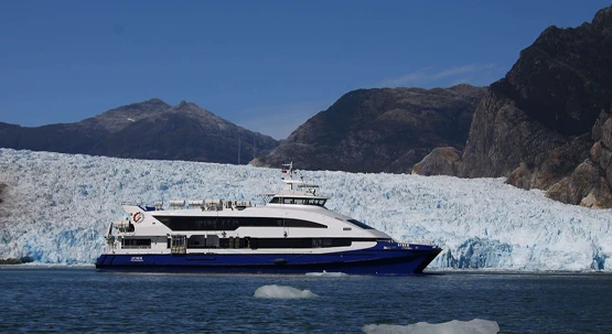
Navegación a la Laguna San Rafael desde Puerto Chacabuco
Desde $285.000.
No te pierdas esta espectacular navegación en catamarán desde Puerto Chacabuco hasta la majestuosa Laguna y Glaciar San Rafael.

Navegación a la Laguna San Rafael desde Puerto Tranquilo
Desde $220.000.
Déjese llevar por la fuerza del glaciar y la vida que lo rodea. Un paisaje de color azul, con impresionantes témpanos de hielo.
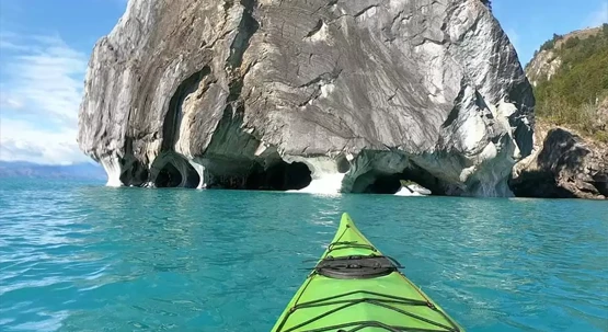
Capillas de Mármol en Kayak
Desde $66.000.
Una experiencia única de navegando sobre las aguas del lago General Carrera hacia las majestuosas Capillas de Mármol.

Descubre la belleza oculta de Chile Chico: Un destino imperdible en la Patagonia Chilena

5 Tips para un viaje exitoso a Carretera Austral

¿Cómo Llegar a la Carretera Austral?
Somos parte de.
Experiencias
- Capillas de mármol
- [email protected]

- Quiénes Somos
- Salidas Grupales
- Circuitos de Viajes
- Planificación a Medida

CARRETERA AUSTRAL COMPLETA 15 días
Recorrerás un trayecto de 1200 kilómetros atravesando la Patagonia Chilena desde Puerto Montt hasta Villa O’Higgins en el extremo austral de Chile. También conocido como Ruta 7, este hermoso recorrido es el primer acercamiento a espesos bosques, lagunas de color turquesa, ríos de aguas intensas, y parques nacionales que protegen a especies de flora y fauna endémica y en peligro de extinción.
El primer tramo va desde Puerto Montt hasta la localidad de La Junta, una ruta que atraviesa la zona sur de la Región de Los Lagos y el comienzo de la Región de Aysén. En esta parte de la ruta están el hermoso Parque Pumalín y la ciudad imperdible de Chaitén. El segundo tramo empieza en La Junta y termina en Coyhaique, capital de la Región. En esta bella zona están el magnífico Parque Nacional Queulat y las lindas localidades de Puyuhuapi y Puerto Cisnes.El tercer tramo de la Ruta 7 comienza en Coyhaique y termina en Villa O’Higgins, el último pueblo de la Carretera Austral desde donde se puede salir a explorar el río Mosco, pescar, hacer montañismo o simplemente descansar. En esta parte del recorrido está la Reserva Nacional Cerro Castillo, perfecta para los adeptos al trekking, el río Baker, el más caudaloso de Chile y paraíso para los amantes del kayak y del rafting; las famosas Capillas de Mármol y los espectaculares Campos de Hielo Norte y Sur. Vive esta aventura con nosotros.
- Descripción
Detalles del tour
15 DIAS RECORRIENDO: HORNOPIRÉN- CHAITÉN- FUTALEUFÚ-PUYUHUAPI-COYHAIQUE-CHILE CHICO-CALETA TORTEL-VILLA O’HIGGINS- PUERTO GUADAL.
SALIDAS DE SEPTIEMBRE A MAYO
- Ticket aéreo Santiago /Puerto Montt/ Balmaceda / Santiago
- Van privada de turismo hasta 6 personas
- 14 noches alojamiento con desayuno.
- 1 noche de alojamiento en Hornopirén.
- 2 noches de alojamiento en Chaitén.
- 1 noche de alojamiento en Futaleufú.
- 2 noches de alojamiento en Puyuhuapi.
- 1 noche de alojamiento en Coyhaique
- 1 noche de alojamiento en Chile Chico
- 1 noche de alojamiento en Puerto Puerto Bertrand.
- 2 noches de alojamiento en caleta Tortel
- 2 noches de alojamiento Villa O´Higgins
- 1 noche de alojamiento Puerto Guadal.
- Navegación Ruta Bimodal, entre Caleta Gonzalo y Hornopirén.
- Visita al Parque Nacional Queulat.
- Visita al Parque Nacional Pumalín (visitaremos bosque de alerces de hasta 3 mil años de antigüedad).
- Caminata Laguna Espejo, Futaleufú.
- Visita Termas.
- Visita al parque Pumalín.
- Visita a la localidad de Lago Verde.
- Visita a Puerto Guadal y sus alrededores.
- Visita a Chile Chico.
- Visita a caleta Tortel.
- Visita al lago General Carrera y a las capillas de Mármol.
- Visita al río Baker.
- Visita al parque Patagonia.
- Guía chofer durante todo el viaje.
EL PROGRAMA NO INCLUYE:
- Excursiones Opcionales
Conversor de moneda
Cotice su reserva, productos relacionados.
PERÚ CHILE GASTRONOMICO
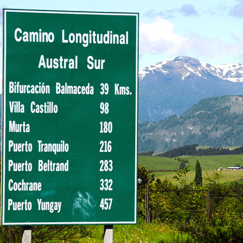
CARRETERA AUSTRAL SUR 9 días
Carretera austral norte 7 días.
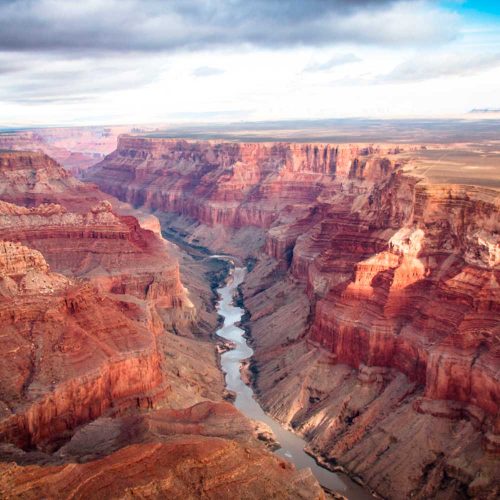
TRIÁNGULO DEL OESTE
- Carretera Austral Sur
- Patagonia Norte y Carretera Austral
La Carretera Austral Sur comienza en Coyhaique y termina Puerto williams. Este es un recorrido que presenta diversos paisajes, como los Campos de Hielo, Reservas y Parques Nacionales. Se caracteriza por sus hermosos paisajes verdes, las aguas cristalinas de los lagos que tiene y los imponentes paisajes que brindan los diversos glaciares de la zona.

- Información General
La Carretera Austral Sur presenta complicadas características geográficas del territorio, en el que predominan los Andes patagónico, lagos, turbulentos ríos y la presencia de campos de hielo, la construcción de la Carretera Austral está en permanente reparación aún cuando la mayor parte de sus tramos están operativos. Por otro lado, gran parte de la ruta carece de pavimentacion.
Gastronomía
El plato típico de la región es el cordero al palo, el que debe atravesarse con una espada y cocerse a las brasas de manera invertida por un poco más de dos horas y media. Este es un proceso largo y familiar que se sirve acompañado de papas, arroz o diversas ensaladas y el infaltable pebre.
Los pescados también son parte esencial de la gastronomía de la Región de Aysén, al igual que en muchas regiones del país existe una gran variedad de pescados y mariscos que son un aporte para los platos típicos de la zona. Dentro de los pescados más consumidos está el salmón, el congrio y la merluza, que se combinan con distintos maricos como los camarones y la centolla.
En materia de bebestibles, en esta zona existe una tradición de tomar vino en una bota de cuero, como la tradición española y también se toma calafate sour, una bebida alcohólica preparada con limón jugo de piña, pisco y calafate, que es un fruto de la rama de los berries. Este también se usa para la preparación de pasteles, kúchenes y otros postres que por lo general llevan mucha fruta.
Cómo llegar
- Avión: Desde Santiago hasta Coyhaique .
- Tour: Estos van a depender del lugar que se quiera ir.
Recomendaciones
El clima es entre marítimo lluvioso (en la zona costera y fiordos) y estepárico frío (cercano a la cordillera). Llueve todo el año incluso en verano. La temperatura media anual es de 8°C.
Es recomendable llevar ropa apta para la lluvia.
Comprar todo lo necesario en las ciudades grandes. El resto de las localidades tienen abastecimientos limitados y con valores muy superiores a lo común.
El comercio en zonas rurales abre durante todo el día, pero cierra entre las 13.00 y las 15.00 horas. Es recomendable llevar efectivo en pesos chilenos ya que no hay posibilidad de pagar con tarjetas en quioscos y locales rurales.
NO dejar basura en los parques ni en la vía pública. Cuidar la naturaleza es responsabilidad de todos. Evite multas.
Mapa de Carretera Austral Sur
Ven a descubrir carretera austral sur, paquetes de viajes en carretera austral sur.
Ven a descubrir Carretera Austral Sur a través de nuestros mejores programas de viajes.

Programa Carretera Austral Perfecto 6 Días
Si quieres conocer la Carretera Austral y aún no te decides cómo hacerlo, puedes dejar de buscar porque ¡este es el itinerario perfecto!…

Programa de Viajes Carretera Austral Full 8 Días
Si quieres recorrer la Carretera Austral y tienes tiempo, este programa es para ti. Navegaremos hacia las Catedrales de Mármol, disfrutaremos…

Programa de viajes Carretera Austral Especial 4 Días
Durante cuatro días conocerás lo mejor de Aysén. Navegaremos en Catamaranes del Sur por la Laguna San Rafael y conoceremos los atractivos…

Programa de viajes Carretera Austral Express 5 Días
Conoce la Carretera Austral en cinco días con navegación incluida a la Laguna San Rafael y relajación en las Aguas Calientes de Ensenada…
- Desde CLP $ 898.000 por persona
- Desde US$ 1.005 por persona
Tours en Carretera Austral Sur
Estos son los mejores tours por el día para conocer lo mejor de Carretera Austral Sur

Navegación en catamarán por la laguna San Rafael 13 Horas
Navegaremos por fiordos y canales de la Patagonia chilena en catamarán desde Puerto Chacabuco hasta el Parque Nacional Laguna San Rafael…

Tour a las Capillas de Mármol 12 Horas
Las Capillas de Mármol fueron declaradas Monumento Nacional por ser formaciones de mineral de carbonato de sodio. Ven a conocer estas…
- Desde CLP $ 110.000 por persona
- Desde US$ 149 por persona

Trekking por el glaciar Exploradores 10 Horas
En esta excursión caminaremos por un bosque siempre verde para culminar en el blanco azulado del glaciar Exploradores en la zona más…

Trekking al campamento del Neozelandés en el Parque Nacional Cerro Castillo 9 Horas
La Carretera Austral esconde espectaculares paisajes y tú podrás conocer parte de ellos en este trekking por el Parque Nacional Cerro…

Rafting en el río Baker 3 Horas
Si amas la adrenalina, esta excursión espectacular te llevará a descargarla por completo, descendiendo los rápidos de clase 2 y 3+…

Kayak por la Reserva Nacional Río Simpson Full day
Conoce los tranquilos lagos y ríos de los alrededores de la Reserva Nacional Río Simpson en este paseo en kayak acompañado de profesionales.…

Rafting por los ríos de Aysén 5 Horas
¡Si te gusta la aventura y naturaleza no te puedes perder esta actividad! Conoce el Río Aysén y su entorno navegando por sus aguas,…
Hoteles en Carretera Austral Sur
Hotel hacienda tres lagos .
Carretera Austral Sur Km 274, Carretera Austral Sur

Hacienda Tres Lagos se encuentra situada en uno de los sectores más hermosos de la Patagonia, enmarcado por tres imponentes lagos;…
Mirador De Guadal Lodge
Camino A Chile Chico Km 2 Puerto Guadal, Carretera Austral Sur

Situado en 10 hectáreas de maravilloso bosque nativo, a orillas del Lago General Carrera y sólo a 10 minutos de distancia de la Carretera…
Terra Luna Lodge
Camino a Chile Chico Km 1,5 Puerto Guadal, Carretera Austral Sur

El Lodge se emplaza a orillas del lago General Carrera, frente a Campo de Hielo Norte y sus impresionantes glaciares Leones, Nef y…
Articulos de interés sobre Carretera Austral Sur
Todo lo que tienes que saber antes de ir al parque laguna san rafael.

¿Sabías que la tercera mayor extensión de hielos continentales del mundo después de Antártida y Groenlandia está en la Carretera Austral?…
- Más información
COP 25. Todo sobre la cumbre del cambio climático más importante del mundo organizada en Chile

¿Qué es la COP 25? ¿cuáles son los temas que se discutirán? entérate de todos los detalles sobre el evento más grande organizado por…
Qué hacer para Fiestas Patrias 2019

Ideas para planear un viaje dentro de Chile para el 18 de septiembre.
Cinco lugares para desconectarte de la ciudad en estas vacaciones de invierno

Conéctate con la naturaleza sin perder el privilegio de la comodidad en estos acogedores destinos.
Ruta de los Parques de la Patagonia: la espectacular ruta escénica más larga del mundo

Conoce la nueva ruta de trekking que cruza 2.800 km de áreas protegidas y hermosos paisajes
Los mejores destinos para visitar en Chile este 2019

Expertos viajeros de Chile dieron sus imperdibles para este 2019
¿Qué llevar en tu maleta si te vas de viaje a la Carretera Austral?

Nos vamos de viaje a recorrer la Carretera Austral sur y es momento de hacer la maleta. ¿Qué llevamos?
Jeinimeni: Lo que tienes que hacer si viajas a Chile Chico

Si estás planeando tus vacaciones, no puedes dejar de visitar la Reserva Nacional Jeinimeni ubicada a pocos kilómetros de Chile Chico…
Turismo Aventura en Chile: ¿Qué excursiones realizar?

Pocos países del mundo pueden ofrecer una variedad de experiencias tan inmensa como la nuestra. Desde las enormes dunas de arena del…
Aysén Patagonia: La nueva apuesta en Chile

Patagonia tiene más de un millón de kilómetros cuadrados, de los cuales un cuarto es chileno, y que abarca los paisajes más extraordinarios…
- +56 2 2570 8620
- Contáctenos aquí!
Full Carretera Austral Sur
Descripción, mapa de full carretera austral sur.

¿Por qué reservar con nosotros?
Mejor precio sin complicaciones, mejor calidad garantizada, atención a pasajeros disponible 24/7, tours y experiencias seleccionadas por expertos, líder en la industria, 18 años de trayectoria, lugares que conocerás.
Lago General Carrera
Lago General Carrera y Río Baker
Santuario de la Naturaleza Capilla de Mármol
Otros tours de coyhaique y carretera austral....

El tour " Full Carretera Austral Sur " ya no está disponible, tenemos algunas alternativas que te van a encantar

Desde USD $2.150

Desde USD $1.880

Desde USD $2.190

- Valle del Huasco
- San Pedro de Atacama
- La Serena y Coquimbo
- Valle de Elqui
- Valle de Copiapó
- Antofagasta
- Limarí y Parque Nacional Fray Jorge
- Alto El Loa
- Bahía Inglesa
- Tagua Tagua – Valle Almahue
- Alto Colchagua y Glaciar Universidad
- Valle de Cachapoal
- Valle del Maule
- Valle de Colchagua y Santa Cruz
- Viña del Mar
- Cajón del Maipo
- Valle Nevado
- El Colorado
- Valle de Curicó
- Valle de Maipo y Pirque
- Valle de Aconcagua
- Santiago Capital
- Isla Robinson Crusoe
- Rancagua y Sewell
- Valle de San Antonio y Leyda
- Valle de Casablanca
- Rano Raraku
- Panguipulli
- Puerto Montt
- Osorno y Puyehue
- Valdivia y Corral
- Temuco y Lago Budi
- Territorio Arauco
- Puerto Varas
- Lago Llanquihue
- Termas de Chillán
- Pucón y Villarrica
- Antártica chilena
- Lago General Carrera
- Tierra del Fuego
- Torres del Paine
- Puerto Natales
- Punta Arenas
- Coyhaique y Puerto Aysén
Carretera Austral
- Vida nocturna
- Entretención familiar
- Playas de la costa
- Playas Lacustres
- Spa y relax
- Cruceros patagónicos
- Navegación de lagos
- Cruceros internacionales
- Contemplación de estrellas
- Visitas a observatorios
- Instalaciones astronómicas
- Pueblos Originarios y Etnoturismo
- Patrimonios de la humanidad
- Arqueología
- Paleontología
- Poesía y Literatura
- Gastronomía típica
- Gastronomía del mundo
- Hiking y trekking
- Ski y snowboard
- Mountainbike
- Montañismo y escalada
- Pesca deportiva
- Kitesurf y deportes náuticos
- Caminatas sobre hielo
- Overland 4×4
- Parapente y deportes aéreos
- Observación de flora y fauna
- Fotografía de paisajes
- Parques y Reservas Nacionales
- Avistamiento de aves

Más de 1.200 kilómetros de belleza natural te esperan en esta Ruta escénica de la Patagonia, única en el mundo. Se trata de la Carretera Austral, un sitio que enamora a todos los que la visitan en automóvil o bicicleta , con paisajes prístinos y un aire que solo respiran los afortunados que conocen esta ruta.
Recorre Chile desde Puerto Montt a Villa O’Higgins, un camino que te permite apreciar la Patagonia chilena en todo su esplendor, cruzando islas casi vírgenes y costas desmembradas en transbordadores. Dueña de una enorme diversidad de paisajes, esta ruta también es ideal para practicar deportes aventura: lánzate en rafting por el río Futaleufú (Región de Los Lagos), o conoce los rincones de este lugar tocado por la varita mágica con una de las tantas rutas de trekking existentes en esta Patagonia Verde.
Combina tu travesía con la visita a los glaciares que adornan uno de los últimos rincones del mundo y sorpréndete con Caleta Tortel (Región de Aysén), un pueblo al sur de Chile con características pasarelas de ciprés.
En la Carretera Austral, conoce un pedazo del paraíso, maravillándote con impresionantes fiordos y glaciares, ventisqueros, lagos de múltiples colores y ríos rodeados de diversos tipos de bosques.
Encuentra información de como llegar al destino
Explora los encantos Carretera Austral
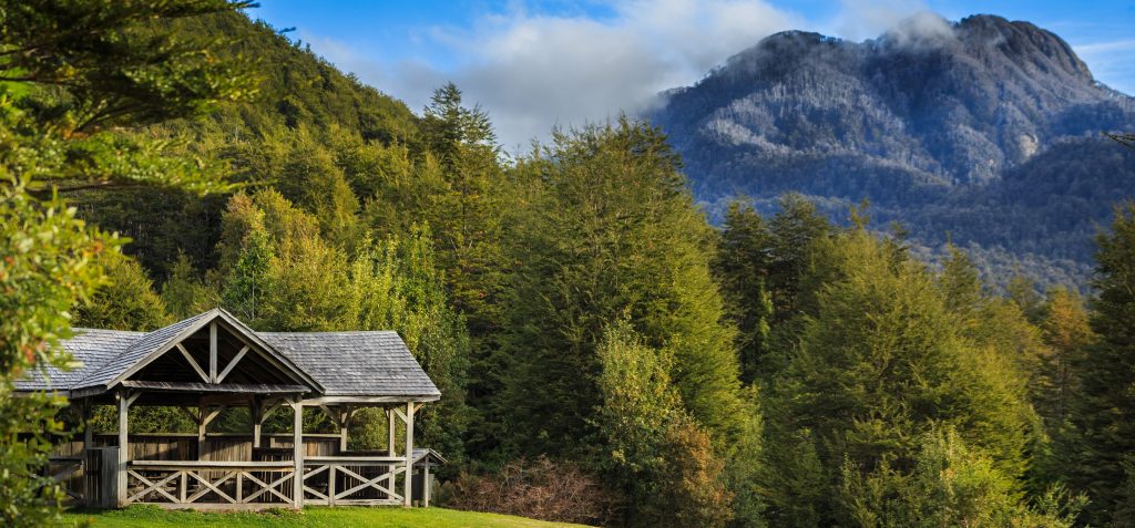
Casi inexplorados por el hombre, estos terrenos de bosque templado lluvioso fueron declarados Santuario de la Naturaleza. Recorre sus senderos aptos para largos viajes, practica trekking y canyoning por sus fiordos, y acampa a los pies de aisladas cascadas secretas.
Explora a caballo el volcán Michimauda, y adéntrate en sus frondosos bosques de alerces a través de los caminos y puentes de madera que recorren el mágico lugar. Agudiza tu vista, el parque acoge un gran número de aves que van desde las garzas y flamencos hasta imponentes cóndores.
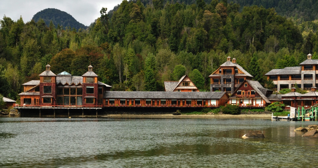
Disfruta un día en los centros de aguas termales de Puyuhuapi y siente cómo tu cuerpo se revitaliza. Con nuevas energías, explora los exóticos bosques de la región a acaballo, haciendo trekking o navegando en sus prístinos ríos.
Dueño de una arquitectura de estilo alemán, recorre sus calles y construcciones de madera que le entregan un toque único al poblado. Reconocido por la fabricación de tejidos artesanales, no olvides comprar un souvenir, hechos a partir de materias primas de la región.
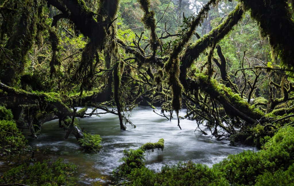
Un lugar donde los árboles parecen sumergirse entre fiordos y canales, donde nace el denominado bosque siempreverde. Ese es el Parque Nacional Queulat.
Déjate encantar por la perfección del Ventisquero Colgante, glaciares, lagunas y saltos que seducen y permiten un espacio de contemplación para disfrutar de la calma de estos paisajes. Si lo tuyo es la aventura, ¡no dejes pasar la oportunidad de practicar deportes náuticos como kayak y rafting para luego reposar en las cálidas termas del sector!
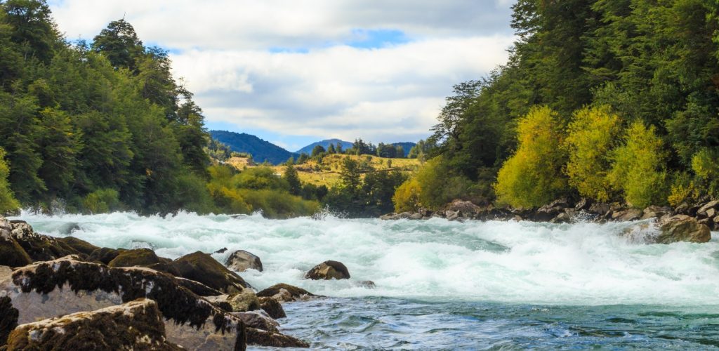
Ubicada en medio de la Cordillera de los Andes, Futaleufú en lengua mapuche significa “río grande”. Verdadero paraíso para los deportes aventura, el río del mismo nombre es considerado entre los tres mejores del mundo para hacer kayak y rafting. ¿Te atreves a desafiarlo?
Si quieres actividades más tranquilas, puedes recorrer a pie o en bicicleta los senderos de la Reserva Nacional Futaleufú que protege a dos especies importantísimas de la zona: el ciprés de la cordillera y el tímido huemul, ciervo endémico y símbolo patrio de Chile.
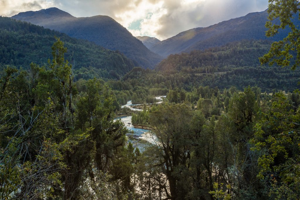
Navegable de cordillera a mar, es un lugar perfecto para la pesca deportiva. Móntate en un cataraft o jet boat y sal al encuentro de los enormes salmones Chinook, cada uno de estos trofeos vivos puede pesar más de 15 kilos.
Camina por sus enormes playas y navega hacia los islotes Las Hermanas. El gran número de lobos marinos y las aves que anidan en este lugar te sorprenderán. Encántate con los delfines australes que siguen las embarcaciones, haciendo enormes saltos y piruetas, y admira los bosques vírgenes que rodean sus orillas.
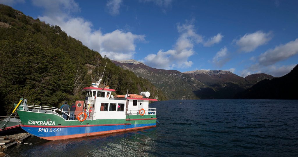
Ruta lacustre de espectaculares paisajes, las montañas que rodean los lagos se reflejan en sus aguas regalando inolvidables postales. Lleva tu caña de pescar, las aguas de estos lagos son reconocidas por ser un paraíso para la pesca con mosca y vadeada.
Dueños de vasta vegetación siempre verde, en sus orillas puedes realizar caminatas, excursiones a caballo y acampar entre sus bosques. Si buscas comodidades, quedarás maravillado con la amabilidad de su gente y la sabrosa comida nacional que sirven directamente en sus hogares.
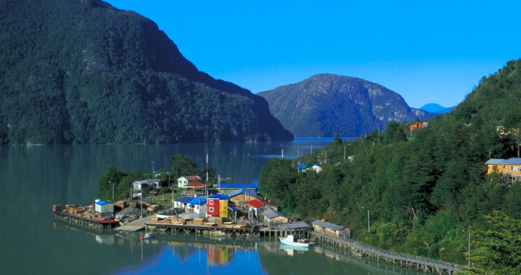
Conocida como la ciudad de las pasarelas, Tortel te invita a recorrer los siete kilómetros y medio de plataformas, puentes y escaleras construidas en madera de ciprés que interconectan los distintos lugares de este pintoresco lugar, declarado Zona Típica por su arquitectura y estilo de vida.
Visita también Villa O’Higgins, último pueblo de la Carretera Austral y un atractivo lugar para el descanso. Practica pesca con mosca, montañismo o simplemente encántate con la vida ganadera. Tras unos días de ocio no querrás volver a los grandes centros urbanos.
Tour Carretera Austral

Ruta 7, Primer Tramo de la Carretera Austral
Recorreremos el sector del primer tramo de la “Carretera Austral”, el cual se conoce como la puerta de entrada hacia los imparables bosques, al centro urbano y portuario de importancia nacional el cual tiene un nexo importante hacia los canales Australes y la Patagonia.
Para dar comienzo a esta aventura nos reuniremos en el kilómetro cero, en el sector de la Plaza de Armas, un lugar lleno de historias sobre la colonización que nos teletransporta por el año 1852, con la creación de sus primeros trazados de calles, nos trasladaremos al sector del Bosque Fósil Peullin, lugar de suma importancia científica y turística, luego de ello, tomaremos rumbo hacia los Corrales de pesca de Pichiquillaipe, lugar conocido por sus construcciones ubicadas en la zona del intermareal, el cual consiste en muros de piedra, que funcionaron como trampas para peces al ser inundados por las mareas altas y despejados al producirse las bajas. Para continuar con la aventura, iremos a visitar la Cascada El Milagro, donde podrás tomar fotografía del bosque, de los pozones de agua natural y además de presenciar como la majestuosa Cordillera de Los Andes va bajando en altura para dar paso a los Fiordos de nuestra Carretera Austral.
Finalmente, para culminar este increíble día realizaremos una navegación por las loberías e Islas Caicura, un sitio de importancia para la conservación de la biodiversidad de aves y mamíferos marinos del Seno de Reloncaví, en donde podremos observar y fotografiar a lobos marinos, toninas, pingüinos, cormoranes, pato yecos, pilpilén Austral, pilpilén negro, gaviota dominicana, gaviota Cáhuil, Gaviota Austral, Gaviota de Franklin y una diversidad de especies que hacen a Caleta La Arena un lugar propicio para el estudio de Avifauna marina.
Lugares Imperdibles
La Plaza de Armas , se ubica en el centro de la ciudad, rodeada de importantes edificios públicos, gobernación, corte de apelaciones, comercio, caracol y la catedral. Aquella es bautizada con el nombre de Buenaventura Martínez, en gratitud al cofundador de la ciudad, la inicial plaza de armas nació junto con el primer trazado de las calles en 1852. Un año más tarde, fue testigo de la fundación de Puerto Montt, cuando Vicente Pérez Rosales, acompañado por el párroco de Ancud, Miguel Sevilla, dos clérigos y un coro de alemanes leyeron el acta fundacional.
La actual Plaza de Armas, llamada Manuel Irarrázaval, ha sido cuatro veces remodelada y tiene entre sus virtudes, ser la primera plaza pública con jardín que tuvo Chile. En este punto neurálgico comienza el kilómetro “0” de la carretera Austral; La conocida ruta 7, que cuenta con alrededor de 1.240 kilómetros, que unen de Puerto Montt a Villa O´Higgins en la región de Aisén.
Bosque Fósil Pelluhuin, «Ubicado en el balneario de Pelluhuin, entre Pelluco y Coihuín, a 5 km al sureste de Puerto Montt, se encuentra este lugar de suma importancia para el patrimonio paleontológico, específicamente paleobotánico, ya que corresponde a uno de los pocos registros existentes de alerces fósiles en nuestro país. El sitio se encuentra en una amplia planicie intermareal de las costas del mar interior del Seno de Reloncaví. En dicha plataforma se hallan los vestigios de un antiguo bosque de alerces y cipreses de las Guaitecas que hoy se encuentran en posesión de vida y con un somero
reemplazo mineral. Pese a esto, son considerados científicamente como fósiles, pues la edad de los troncos ha sido datada, mediante la técnica del radiocarbono, de entre 42.600 y 49.780 años. Investigadores señalan que el bosque de alerces habría quedado sepultado bajo las cenizas de una erupción volcánica, que luego se convirtió en una dura arenisca. Por esta razón, de ellos hoy sólo quedan los tocones, es decir, parte de los troncos que sobrevivieron tanto a la erosión marina, el paso del tiempo y a la cada vez mayor intervención humana.
El área resulta de vital importancia pues solo aquí, hasta el momento, se han encontrado alerces fósiles en el país. Las teorías científicas sostienen que el sitio, antes sumergido, habría quedado expuesto como secuencia del terremoto de 1960 y el movimiento de las placas tectónicas que provocaron el levantamiento de la tierra, propiciando la exposición de los fósiles cuando baja la marea. El límite de los afloramientos está dado por la presencia de un micro acantilado que conforma un barranco, desarrollado en forma lineal y paralela a la costa. A sus pies se encuentra la plataforma intermareal donde se emplazan los alerces fósiles, sin evidencias de mayor inclinación. El sedimento que los contiene corresponde a areniscas conglomeráticas parcialmente consolidadas. En el área se destaca, además, la presencia de aves marinas tales como gaviotas y zarapitos. También son frecuentes las formas de vida litorales propias de la zona intermareal, como peces y crustáceos. Debido a todas las características que convierten a este bosque en un representante único de fósiles de alerce, es que en 1978 el Bosque Sub Fósil de Punta Pelluco fue declarado como Monumento Nacional, en la categoría de Santuario de la Naturaleza, a fin de promover su conservación.»
Los Corrales de pesca de Pichiquillaipe , corresponden a construcciones ubicadas en la zona del intermareal a 21 kilómetros del km 0, consisten en muros de piedra, varas y ramas, u otros materiales, que funcionan como trampas para peces al ser inundados por las mareas altas y despejados al producirse las bajas. Corresponde a un arte de pesca bastante extendido en el mundo, sin embargo, en nuestro actual territorio nacional se acotan al mar interior desde el Seno de Reloncaví hasta Tierra del Fuego.
Fueron mencionados por primera vez por las crónicas de Jerónimo de Vivar durante la conquista española, tras lo cual se pueden encontrar diversos documentos de cronistas, viajeros, sacerdotes, a lo largo de los siglos que hacen referencia a ellos. Su uso fue documentado para los diversos grupos indígenas que habitaron el sur del país; Chonos, Kawésqar (Alacalufes), Yámanas (Yaganes), Huilliche y posiblemente Selknam (Onas), siendo su uso posteriormente adoptado por la población mestiza, especialmente en el área de Chiloé, ocupándose hasta tiempos históricos recientes. En solo el Seno del Reloncaví existen más de 300 Corrales de Pesca, catastrados por científicos, dentro de nuestra Carretera Austral, predominan los que están ubicados en el Sector de Pichiquillaipe.
Para acceder a ellos, se sale desde la Plaza de Armas de Puerto Montt, se dirige al este por Calle Urmeneta hacia Bernardo O Higgins, a 250 mts. Gira a la derecha con dirección a Calle Illapel, luego a 70 mts. Se gira a la izquierda con dirección a Calle Antonio Varas. A 140 mts. Se gira a la derecha con dirección a Calle Copiapó, para luego a 270 mts. Se gira a la izquierda con dirección a la Avda. Juan Soler Manfredini, para luego continuar hasta llegar al balneario Pelluco, después girar a la izquierda para continuar después de 21 kms. Y llegar finalmente hasta Quillaipe, también puedes acceder por servicio privado y buses que salen desde el terminal.
El tiempo de viaje es de aprox. De 25 minutos. Para acceder a ellos debe entrar por el camino que lleva a la escuela del sector y llegar hasta una plazoleta ubicada a unos metros de la playa y al lado de un paradero. Si uno se baja acá (todavía se puede avanzar unos cientos de metros más en vehículo), solo queda caminar.
Fundamental para poder verlos es ir en horario de marea baja. El más grande y visible a simple vista se encuentra justo en la punta, al que se llega en media hora caminando desde la plazoleta. El segundo, más pequeño y menos visible debido a un mayor deterioro, se encuentra a unos 50 metros al poniente del primero»
Cascada “El Milagro”, ubicada a 45 km del km 0, un salto natural de aproximadamente 4 mts, que está ubicada en un predio particular en donde solo debes cancelar $1.000, para poder ingresar al sendero. El sendero es de mediana intensidad, apto para jóvenes y adultos que se encuentren bien de salud con un estado físico moderado; Esta inserto dentro de la cordillera de Quillaipe, bosque húmedo siempre verde. Dentro del sendero, podrás tomar fotografía del bosque, los pozones de agua natural y además de presenciar como la majestuosa Cordillera de Los Andes va bajando en altura para dar paso a los Fiordos de nuestra Carretera Austral.
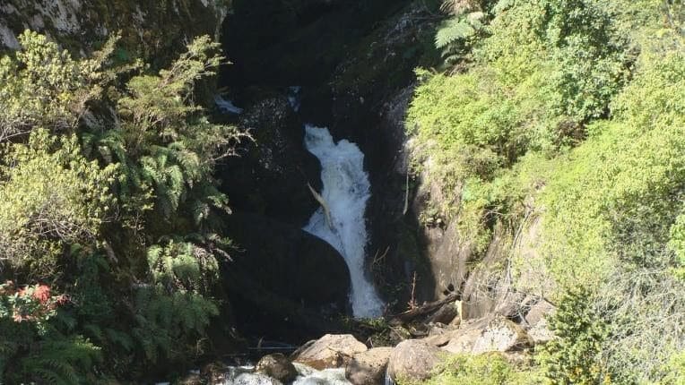
Para acceder desde el Km 0 de la Carretera Austral debes comenzar en la Plaza de Armas de la ciudad de Puerto Montt, y debes tomar la Ruta Costera hacia el balneario Pelluco, el cual es el inicio de esta aventura, en donde con tu vehículo puedes tomar la decisión de viajar los primeros 45 km, hasta Caleta La Arena y en el sector de la capilla, doblar a mano izquierda, subir 900 mts en donde se encuentra la entrada al sendero, lugar en donde puedes dejar tu vehículo. También puedes acceder tomando un bus en el terminal de buses que se dirija hacia Caleta la Arena o tomar un servicio particular que te acerque hasta la entrada.
Navegación por Loberías e Islas Caicura, Ubicados en el Estuario de Reloncaví, cuyas aguas desembocan los ríos Petrohué, Cochamó y Puelo. Este atractivo natural es demandado tanto para la navegación, como el turismo y deportes náuticos, entre otros. En sus aguas habitan una abundante avifauna que pueden ser contempladas en atractivas excursiones, paseos y diferentes actividades que buscan potenciar turísticamente el sector. Las loberías y las islas Caicura son el principal atractivo para divisar la fauna que habita en la Caleta. En ellas se pueden observar: lobos marinos, toninas, pingüinos, cormoranes, pato yecos, pilpilén Austral, pilpilén negro, gaviota dominicana, gaviota Cáhuil, Gaviota Austral, Gaviota de Franklin y una diversidad de especies que hacen a Caleta La Arena un lugar propicio para el estudio de Avifauna marina, contacto para la navegación: Sindicato de Boteros de Caleta la Arena +56942199766.
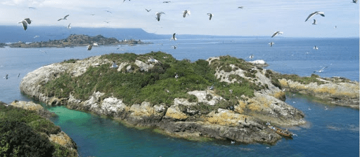
Puedes Acceder a través de buses que los tomas en el terminal con dirección hacia Caleta la Arena, También puedes arrendar un servicio privado, otra opción es a través de un vehículo particular. Partes desde el Km 0 de la Carretera Austral ubicado en la Plaza de Armas de la ciudad de Puerto Montt, y debes tomar la Ruta Costera hacia el balneario Pelluco, el cual es el inicio de esta aventura, en donde con tu vehículo puedes tomar la decisión de viajar los primeros 45 km, hasta Caleta La Arena y conocer los diferentes pueblos insertos en la Ruta. En el embarcadero deberás preguntar por el sindicado de pescadores de Caleta La Arenas, los cuales ofrecen el tour. Se recomienda llamar por teléfono para reservar la actividad.
¿Cómo llégar?
Para acceder a cada uno de estos lugares puede ser a través de vehículos motorizados, buses, bicicletas, entre otro cualquier tipo de movilización o sistema que le permita poder desplazarse por la ruta.
Los atractivos Turísticos del primer tramo de la Carretera Austral, se desplazan en un tramo de 60.7 kilómetros, presentando una dificultad baja de recorrido, apto para jóvenes y adultos de todas las edades, que sientan un interés por conocer los atractivos dentro de la ruta.

Artículos Relacionados

Puerto Montt despide el verano con Fiesta Electrónica y Carrera de Garzones
Feb 26, 2024
Ambas actividades son de acceso liberado y poseen un concurso para ser parte de estas experiencias. Camareros y camareras de distintos locales gastronómicos de Puerto Montt pondrán a prueba sus habilidades, técnicas y velocidad en lo que será la primera Carrera de...

Participa en La Carrera de Garzones
Feb 13, 2024
La Dirección de Turismo de la Municipalidad de Puerto Montt te invitan a participar de la primera versión de este emocionante desafío en el que surgirá toda la garra, la velocidad y resistencia de los trabajadores delos restaurantes de nuestra comuna. Hay premios y el...

Siete restaurantes buscan el voto popular online del Concurso de Sandwichería Creativa Puerto Montt 2024
Jun 3, 2024
Se puede elegir a través de www.saboresdelpuerto.cl, web de la Dirección de Turismo de la Municipalidad de Puerto Montt, organizadora de un certamen que busca ampliar con sabrosas variantes, la más popular de las recetas de la ciudad. Preparaciones basadas en panes...

A través de campaña buscan restaurar fachada de la Catedral de Puerto Montt
May 29, 2024
En 120 millones de pesos se calculan los gastos para mejoramiento del templo patrimonial. Con el objetivo de recuperar la fachada de la Catedral de Puerto Montt, icónica estructura patrimonial y atractivo turístico de la ciudad, el Arzobispado de Puerto Montt lanzó...

Taller de Retablos Patrimoniales para niños se impartirá de forma gratuita en Alerce
May 17, 2024
Los usuarios aprenderán las nociones básicas de arquitectura patrimonial junto a experimentada diseñadora con casi 20 años de trayectoria. Aprender el oficio de construir fachadas de casas patrimoniales a través de un taller con una destacada artista, es uno de los...
IMAGES
COMMENTS
Carretera Austral Sur ¡Bienvenidos a un espectacular viaje de 6 días y 5 noches a través de la sorprendente belleza de Coyhaique, Puerto Río Tranquilo y Cochrane! ... City tour en Coyhaique, entrada a la Carretera Austral. Navegación al Santuario de la Naturaleza Capillas de Mármol, uno de los mayores hitos del viaje.
23 de January de 2024 by Flor Vallejo. In this complete guide to travel the Carretera Austral you will find information to travel the scenic Chile's Southern Highway, one of the most beautiful in the world. The Carretera Austral starts in the city of Puerto Montt, crosses scenic landscapes between lakes and mountains, culminating after 1230 ...
Carretera Austral Sur. Naturaleza/ Paisajes / Sur / Patagonia ... City Tour Coyhaique. Asado Patagón de despedida. Asistencia en viajes, Mapfre Asistencia (aplica límite de edad)**. Tasas de aeropuerto. ** El programa opera con un mínimo de 8 pasajeros. Santiago/Balmaceda H2 031 09:00/11:17;
9. Si quieres recorrer la Carretera Austral y tienes tiempo, este programa es para ti. Navegaremos hacia las Catedrales de Mármol, disfrutaremos de Aguas Calientes de Ensenada Perez, y finalmente descubriremos los milenarios témpanos de la Laguna San Rafael en un viaje de 8 días. Itinerario.
The Carretera Austral (which means "Southern Highway") refers to the 1,240-kilometer (770-mile) road that runs from Puerto Montt to Villa O'Higgins all the way through northern Chilean Patagonia. Also known as Ruta 7 ("Route 7") or the "Ruta Austral" (the "Southern Route"), this road connects its northernmost point, Puerto ...
What to do in Carretera Austral Sur. These are the best day tours in Carretera Austral Sur. Catamaran sailing through the San Rafael lagoon 13 Hours. We will navigate fjords and channels of the Chilean Patagonia by catamaran from Puerto Chacabuco to the Laguna San Rafael National… See Tour; On Request; On Request; Marble Chapels Tour 12 Hours
Drive 2.5 hours further south to find Valle Chacabuco. Use Valle Chacabuco as a rest stop—or hike the 14-mile Lagunas Altas Trail to spot guanacos and condors among the alpine lakes. Finish the ...
Tours. Carretera Austral Sur. La Carretera Austral Sur comienza en Coyhaique y termina Puerto williams. Estees un recorrido que presenta diversos paisajes, como los Campos de Hielo,Reservas y Parques Nacionales. Se caracteriza por sus hermosos paisajes verdes,las aguas cristalinas de los lagos que tiene y los imponentes paisajes quebrindan los ...
Carretera Austral Sur - Chile 8 Days . The Chelenko Experience ... Aysen Journeys is a specialized tour operator in the Aysen Region in the Chilean Patagonia. We create amazing trips to this remote and unknown place of the world, la Carretera Austral.
Carretera Austral Sur (40) $595,000 $935,000 Ahorras 36% ($340,000) Fecha AdultosPago CARRETERA AUSTRAL SUR 6 DÍAS - 5 NOCHES DISFRUTA DE LOS MEJORES. ... Tour apto para todas las edades. "Programa Completo": vuelos, alojamiento, alimentación, actividades incluidas.
Aquí encontrarás todo lo que necesitas para vivir una experiencia inolvidable en uno de los destinos más hermosos y salvajes del mundo. Explora sus bosques milenarios, maravíllate con sus glaciares y observa la fauna autóctona en su hábitat natural. Estamos aquí para ayudarte a hacer realidad tus sueños de viaje.
Carretera Austral was one of the best trips we've ever done. The pristine nature and epic scenery, in combination with absolute freedom, was an experience we will never forget. And we will always keep fond memories of our trip to Patagonia. Carretera Austral in Chilean Patagonia is one of the world's finest road trips. The scenery along the way ...
Kilometer 200 of the Carretera Austral is located in the town of Chaitén, and from there it travels through the Aysen region at kilometer 547 which is access to Puerto Aysen. Kilometer 610 corresponds to the city of Coyhaique and kilometer 657 goes to Balmaceda. From there you take a new ferry from the areas of Puerto Yungay and Rio Bravo.
Estimado visitante, ofrecemos tours Carretera Austral, camino longitudinal del sur de Chile que se inicia en Puerto Montt y Termina en Villa O´higgins, en total 1.240 kilómetros que constituyen un espacio impactante para el turismo, dando cabida al desarrollo de diversas actividades tanto de ocio como deportes, transporte, investigación, expediciones y aventuras.
Carretera Austral. More than 1,200 kilometers of natural beauty await you on this scenic Patagonian Route, unique in the world. The Austral Highway enchants all those who visit it by car or bicycle with pristine landscapes and an air that only those lucky enough to know this route can breathe. Possessing an enormous diversity of landscapes, it ...
Detalles del tour. DESDE: $950.000. SALIDAS DESDE SEPTIEMBRE A MAYO. 9 DIAS RECORRIENDO: COYHAIQUE-CHILE CHICO-CALETA TORTEL-VILLA O'HIGGINS- PUERTO GUADAL. INCLUYE. Ticket aéreo Santiago / Balmaceda / Santiago. Recorrido en van privada hasta 6 personas por Carretera Austral Sur. 1 noche de alojamiento en Coyhaique.
Discover the Carretera Austral Chile with this definitive guide. Find out everything you need to know to plan the perfect trip to Patagonia.
Nuestro Recorrido. En Gran Patagonia, nuestra pasión es ofrecer experiencias sorprendentes y memorables a lo largo de toda la Carretera Austral en Aysén y Patagonia Sur en Magallanes. Fundada hace más de 30 años en Coyhaique, nos hemos establecido como el tour operador líder en la Patagonia.
CARRETERA AUSTRAL COMPLETA. 15 días. Recorrerás un trayecto de 1200 kilómetros atravesando la Patagonia Chilena desde Puerto Montt hasta Villa O'Higgins en el extremo austral de Chile. También conocido como Ruta 7, este hermoso recorrido es el primer acercamiento a espesos bosques, lagunas de color turquesa, ríos de aguas intensas, y ...
Tours en Carretera Austral Sur. Estos son los mejores tours por el día para conocer lo mejor de Carretera Austral Sur. Navegación en catamarán por la laguna San Rafael 13 Horas. Navegaremos por fiordos y canales de la Patagonia chilena en catamarán desde Puerto Chacabuco hasta el Parque Nacional Laguna San Rafael… Ver Tour; A Pedido; A Pedido
Reserva de tour para la Carretera Austral en Mallin Colorado Ecolodge, excursiones a glaciares, chile chico, lago general carrera. +56 2 2570 8620; ... El tour "Full Carretera Austral Sur" ya no está disponible, tenemos algunas alternativas que te van a encantar. DesdeUSD $1.005.
Más de 1.200 kilómetros de belleza natural te esperan en esta Ruta escénica de la Patagonia, única en el mundo. Se trata de la Carretera Austral, un sitio que enamora a todos los que la visitan en automóvil o bicicleta, con paisajes prístinos y un aire que solo respiran los afortunados que conocen esta ruta.. Recorre Chile desde Puerto Montt a Villa O'Higgins, un camino que te permite ...
En este punto neurálgico comienza el kilómetro "0" de la carretera Austral; La conocida ruta 7, que cuenta con alrededor de 1.240 kilómetros, que unen de Puerto Montt a Villa O´Higgins en la región de Aisén. Bosque Fósil Pelluhuin, «Ubicado en el balneario de Pelluhuin, entre Pelluco y Coihuín, a 5 km al sureste de Puerto Montt, se ...